Time travel: 10 Israeli archeological sites you should visit this summer
From ancient ruin to medieval forts, these sites are full of history and breathtaking views.
The guides at Keshet Yonatan, a center dedicated to educating the public about historical travel in Israel, in cooperation with the Eshkolot forum, have gathered a list of archeological sites open to the public. Family, groups, and individuals can all take trips to these sites.
The site at the banks of the Ein Gev river
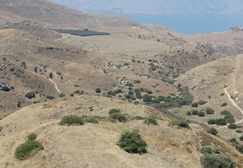
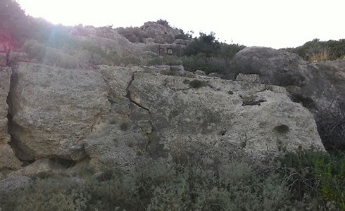
One speculation regarding this site is that it was the place where the biblical king of Aram-Damascus, Ben Hadad, fled after succumbing in battle to King Ahab of Israel. Traveling down the northern branch of the ancient hill reveals an exposed layer of rock. Only after a closer inspection are visitors likely to spot the remains of the ancient banks, and even the site of an old game-related floor space.
How to get there: Drive on Route 98 in the Golan Heights. After 22 kilometers, veer into the side road. After another kilometer, you will arrive at the Golan pathway (marked in the colors white-green-blue). From here, start walking along the marked dirt path, which will start with a downward slope and later shift mildly upward to the north. On your left, you'll notice a low hill start to rise: it's recommended that you climb it carefully to discover the archeological remnants of structures, including an ancient wall and water reservoirs.
Gilgal Refaim in the Golan Hights
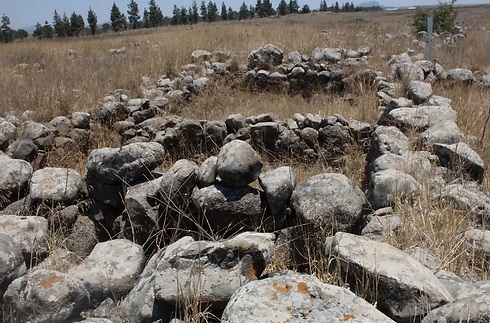
Also known by its Arabic name, Rujm el-Hiri, this archeological site is full of riddles. Filled with 10,000 tons of stones and basalt rocks, no one yet knows why so many were gathered in one place: Is it an astronomical center, a tribal area, or an environmental temple, and what is the meaning of the stone circles there? Tourist literature doesn't feature any information about the original structure at the center of the site, but there's no doubt about the breathtaking view it creates.
How to get there: Drive on Route 808 and follow the road signs to Moshav Yonatan. Drive across the moshav towards the back gate, and go on driving until you reach a T-junction. Turn right, and keep going for another kilometer until the road veers at a right angle. Keep straight and make sure you're on the Golan pathway by taking note of the road markers.
Access to the site requires driving a kilometer on dirt roads, which can be comfortably crossed by most vehicles, meaning families shouldn't be deterred. At the intersection, take the first right exit until you reach a high-rising eucalyptus tree next to a natural spring. Keep going on foot, until you reach a left turn that features the Golan road mark (blue-green-white). Keep walking 500 more meters, and you'll reach the site.
The Daniela Ruins (Khurvat Daniela)
Entering the site, you'll see the remains of a Jewish village from Talmudic times, including olive presses, water reservoirs, alleys, and houses. The village residents took advantage of the geographic conditions in the Upper Galilee - including rock types, rainfall, and a comfortable climate – to plant vast olive groves, from which they produced large quantities of high-quality oil.
The oil was sent to Roman-ruled parts of Europe, as well as Byzantine areas of Asia, with the financial returns greatly contributing to the local residents' quality of life. Some left for big cities, but others stayed in the village and invested in developing their agricultural equipment, the remains of which can be seen to this day.
How to get there: Drive on route 899, taking note of the sign pointing toward Nahal Sarach, and turn north toward the Khurvat Daniela parking lot.
The Karta Ruins (Hurvat Karta)
This site includes views of the Atlit bay, as well as archeological remains from the times of the Knights Templar, including a fortress that survived all of the Muslim attacks of 1187. Today, the site hosts the saltwater pools from which much of Israel's salt supply is derived. At the north you'll find the Carmel Beach, with the moshava of Atlit to the south.
How to get there: Drive on the Atlit access road (7110). Close to the nearby gas station, you'll find a traveler's parking station. Park there, and walk west towards the sea, climbing the eolianite ridge.
Rasm Harbush
Rasm Harbush is a large Chalcolithic (Copper Age) site discovered in the Golan fairly recently – before 1973 there was no known information about the Chalcolithic period in the region. The Chalcolithic period occurred roughly between 4,500-3,500 BCE, and is historically connected to different areas inside Israel and in its general vicinity.
Rasm Harbush is a representation of a typical Chalcolithic settlement from around 5,000 years ago. The settlers built their houses out of basalt stones found locally, without using chiseling techniques or binding materials. Some of the farming equipment was also basalt, in addition to the tools made from flint rock and clay. The residents were mostly herders and farmers, and the lack of a defensive wall seems to indicate that the locals lived quiet and peaceful lives.
Among the items found at the site is one of the identifying marks of the period in the Golan: The basalt pillars that the locals erected for the purpose of sacrifice, in order to ensure plentiful crops and healthy herds. Carved into the pillars were statues showing schematic human and animal-like appearances, with all kinds of special features. The local houses, like virtually all houses at the time, are rectangular wide-frame homes. Each house's long side generally passes from east to west, with a southern entrance. Most houses are built in rows, with dividing walls between them.
How to get there: Drive along route 808 and turn toward Moshav Yonatan. On the way, look for a sign indicating the right turn to Rasm Harbush.
Tel Hushania
The Tel Hushania site includes ruins and remnants from the Byzantine, Mamluk, and Circassian periods. When you enter, you'll find many fruit trees, water reservoirs (which are usually dry), and beautiful vistas. The meaning of the name "Hushania" remainss a mystery to this day. There are those who believe it might have originated as the name of a town in the days of the second Jewish temple.
The local remains show the historic value of Route 87 as one where an ancient road once passed, probably between the Bnot Ya'akov Bridge, through the Rafid junction eastward. The Circassians, who came to the region after being forcefully removed from the Caucasus by the Russians, are responsible for most of the structures and fruit-bearing trees on the hill, which could indicate their level of technological development and aspired-to quality of life.
How to get there: Drive 32 kilometers on route 87. The road veers left onto a road that leads to Tel Hushania.
Ein Pik
The site is named after an abandoned Syrian village (Pik), whose residents fled in 1967. Some of the ancient Jewish homes in the site show marks of Byzantine times, when the village was a large commercial center. One indication of the Jewish presence is the writing "Ana Yehuda hazana" – translated as "I am Judah the cantor" – discovered on a pole in the village. In the 19th century, the area was occupied by the owners of the Golan Heights lands, who sold them to the settlers of Bnei Yehuda.
How to get there: Take route 98 from the north, pass the Afik junction and continue one kilometer. Take the second right turn into a dirt road that will lead you to Ein Afik. Exit the vehicle and enter a basalt complex and a pathway leading to a renovated Syrian village. Stick to the path's left side the entire way, and after a few dozen meters waking between the village's houses you'll arrive at a cliff, featuring a beautiful view of the Sea of Galilee and southern Golan Heights. Go down the stairs to the left until you reach a pool, with the source of the local spring nearby.
Dir Aziz
Dir Aziz is an abandoned Syrian village that was built on the ruins of a Jewish settlement from Talmudic times. The village houses a synagogue, olive presses, and a spring with an artificial pool, inside a eucalyptus grove. The pool is rectangular, fairly large, and about one meter deep. The spring area was renovated by the people of Kanaf, a moshav in the Golan Heights, in memory of their friend Asher "Ashi" Novik, who died in the Second Lebanon War.
Archeological digs performed at the site in the 1990s revealed an impressive synagogue from the sixth century CE, which served as a spiritual and communal center for the local Jewish population. The synagogue is unique in its build: It was constructed to have its inhabitants pray in the direction of southern Jerusalem.
The synagogue's prayer bench has been preserved, and the southwestern wall has an indentation in it that is assumed to have contained the Torah Ark. A line of Greek writing has been revealed on the bimah (main platform) of the synagogue, containing the name Judah and the number 295, presumably marking the number of years since the fall of the Second Temple. In addition, one of the synagogue's door frames has the Greek word "AZIZO" written on it, indicating that Aziz was the original name of the Talmudic-era settlement that occupied the land.
How to get there: From route 869, take a turn toward Yeshuv Kanaf. Drive 1.5 kilometers and turn left shortly before the yeshuv's entrance. Drive through an area of cowsheds and chicken coops, pass the Kanaf industrial area, and exit through the gate a few hundred meters later. Continue driving on the dirt road with the black road marker, parallel to the nearby creek. After two kilometers you should see an open space for parking on your right, where you'll notice a sign next to a wooden staircase that goes down to the local spring. Looking up and to the left, you'll be able to see the old Dir Aziz synagogue.
Khirbet Kanaf
Khirbet Kanaf, or the Kanaf Ruins, is a site that houses the remains of an Arab village which once stood there, chief among them a large basalt structure, whose black stones are held together with yellowish plaster. The structure was used by villagers to store crops, and is located on the grounds where a Jewish synagogue stood in Talmudic times.
The old synagogue's front was on the west side, with the secondary opening on the north-east.
At the starting point of the ascent to the site stands a monument commemorating two Israeli soldiers who were killed when they stepped on a mine on the last day of the Six Day War.
How to get there: From route 869, turn right toward Yeshuv Kanaf. Enter the yeshuv and immediately turn left. Go straight until you reach another gate, park your car and start walking on the path marked black, until you reach Khirbet Kanaf.
The Matzad Ateret Fort
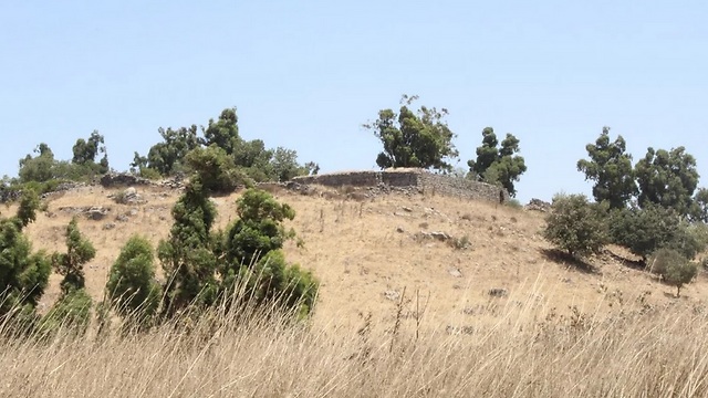
A 12th-century templar fort located on the banks of the Jordan river, about a kilometer south of the Bnot Ya'akov Bridge. The fort was built in the shape of a square with a high tower at its center and a wall surrounding it. It was built to secure the bridge that crosses the Jordan river, which housed the main road between Tiberias and Damascus.
Prior to the fort's construction, the area was guarded by an order of knights and was considered fairly safe, thanks to its distance from population centers. When tensions grew between the Knights Templar and the Muslims in the region, the Templars decided to build the fortress in order to protect the area. This step angered Saladin, causing him to start a war.
After a number of attempts at conquering the fort, Saladin's Muslim forces eventually managed to take it over and win the battle. They razed it to the ground, and that's the state it remains in today.
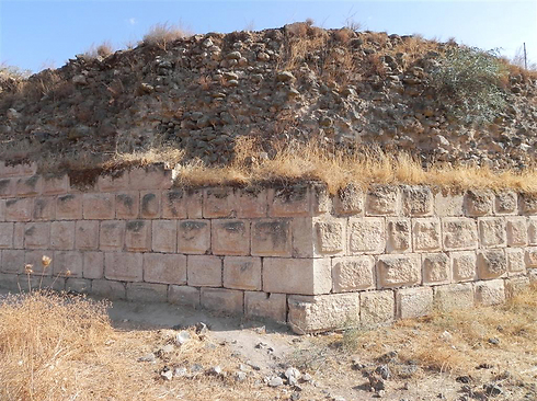
Looking closely, visitors can see that the fort's wall is decorated with different shapes and symbols, which the Templar workers engraved in order to leave their mark.
The fort's walls also feature a unique characteristic: A representation of the Great Syrian-African Rift Valley. A vertical fracture was first discovered in the middle of the north and south walls in 1994, their eastern sides having "moved" over about two meters to the north when compared with the western sides. Experts investigated this phenomenon and came to the conclusion that earthquakes were what affected the walls' movement, since the fort was built on the very center of the rift. The movement by these walls is a precise measure by which the movement of tectonic plates in the region can be studied.
How to get there: From Mahanayim, take route 91, passing the Gadot and Mishmar HaYarden junctions. In the middle of the curve in the road, take the right turn onto a dirt road, leading to a eucalyptus grove. Park your vehicle and look for the path and gate that lead to the fort.
Special thanks to the instructors at Keshet Yonatan, in cooperation with Eshkolot – a forum for tourism and Israeli consciousness.


