


Wadi Ara, the place to be
25 Jewish and Arab tour guides offer their services to visitors in Wadi Ara region, which is much more than a just a road leading to Sea of Galilee

Israelis eat Humus at Abu Gosh, buy fish and meat in Jaffa and love to wonder the colorful markets of Nazareth and Akko. Somehow, everyone skips over the region of Wadi Ara. They pass by on the way to the Sea of Galilee, and if anything, stop on the side of the road to buy olive oil in front of Umm El-Fahm or fill up gas at the entrance to Kfar Kara.
There is more than one reason to change the attitude towards this region whose residents are friendly and welcoming. The natural panorama in the area is astounding, and from the highest observation spots one can see the Green Line of yore, the new separation fence, a village and a town, a Jew neighboring an Arab.
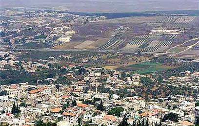
Wadi Ara (Photo: GPO)
“Chance” foundation, whose members are Jews and Arabs, runs a project for cooperation between the Jewish and Arab municipalities in the areas of employment, environment and tourism. Yuval Tamari, one of the foundation members, explains: “We have gathered 25 Jewish and Arab tour guides, and they offer their services to every backpacker, group or family.”
We joined the trek which combines several trails and tour guides. We heard childhood tales of Bilel Akel from Arara, and at the alleyways of Umm El-Fahm we were escorted by Muhammad Rabah, an environmental engineer.
In total, the price per person in a group of 20, with a van for the whole day, tour guides and food expenses, may reach about NIS 200. To coordinate a tour, feel free to contact the following guides – Muhammad Rabah (Umm El-Fahm): 972-50-5312314; Tal Raz (Katzir): 972-52-2841513; Bilel Akel (Arara): 972-50-2147231.
Independent travelers will spend on a home-made meal at Umm El-Fahm or one of the nearby villages around NIS 50-70 per person. Humus and shish-kebbabs in one of the local restaurants will cost around NIS 30.
Trail 1: From Katzir to Arara
Time: 2 hours
Length: 1.5 Km
Drive down Wadi Ara Road (No. 65) and look for the sign pointing to Katzir (3 Km before or after the No. 6 Road bridge, depending on where you arrive from). Go up Amir Mountain until you reach the community. Start with two astounding observation points on both sides of the range, and from the entrance to the settlement, depart for the ancient site “El-Ahwat” (The Walls in Arabic), which surprisingly enough is built in similar form as sites dated from the first century B.C. that were discovered in Sardinia. On site “Harpushiot” (ancient seals) and additional evidence of trade with Egypt and the region were discovered.
From there, go down the mountain towards Ein Zeitun Spring, which is located among the upper houses of Arara. Arara’s graveyard, built around Sheikh Halaf’s grave at the center of the range, allow a beautiful view of the center of the village.
From the graveyard go down to the center of the village, where one can visit the mosque, get lost in the alleyways and end up at the “Bidar”. It is the ancient center of the village where the grains would be brought in during harvest time, and were celebrations and festivities were held. From here, one can take a taxi toward Katzir, a seven minute drive thought Ein A-Sahla. In Katzir it is recommended to visit the artists’ homes (coordinate in advance).
Trail 2: Wadi Sari’a
Time: 3 hours
Length: 4 Km
Drive towards Moshav Mei Ami (No. 6535 Road that is an offshoot of Wadi Ara Road west of Umm El-Fahm). At the entrance to Mei Ami, turn left. After a going down for about 300 meters, turn right into a trail marked in blue, and gradually descend toward south west, in between the chicken coops of Mei Ami (About 45 minutes).
The place where the trail meets the wadi is called Einot Sharia, and one should stop there to explore its hidden treasures: impressive trees, a small graveyard and some buildings. From here on end the trail is along the southern bank (on your left when descending) of the wadi, until one reaches Ein El-Malake, a small village of several families in the middle of the forest. To go back to the cars at Mei Ami, just walk along the road.
Trail 3: Umm El-Fahm
Time: 3 hours
Length: 4 Km
The name Umm El-Fahm (literally - “the Mother of Coal”) is taken from the coal industry that was prevalent in the area. After entering the city, one must pass through three roundabouts until reaching an art gallery, where the car can be parked. From the gallery, walk up the road towards Ibn Sina Square, which was the ”Bidar” of the Mahagshane tribe. At the square there is the famous Ibn Sina Humus joint and at the grocery store one can find fresh vegetables and herbs that the locals gather.
Walk up and at the junction turn towards El Mahagshane Market, the historic center of the city: narrow and wide alleyways, interior and exterior yards and ancient and modern houses. Up the market, turn left and pay notice to the turret and golden dome of Omar Ibn El-Hitab Mosque. The mosque’s lot becomes a fruit and vegetable market in the morning, and on Fridays one can also find clothing shoes, household appliances and CD’s.
Not far from there stands Abu Obeida Mosque, which was first erected in the 1940’s, underwent renovation in 1989, and today also includes a local health clinic and a cultural center. From the mosque continue due east towards the tomb of Sheikh Aksander and the adjacent mosque up the mountain.
From the north-eastern point on the mountain start descending back towards the town, as one passes by the communal garden at El-Halil neighborhood. It was set up as part of an environmental design project by the local art gallery. Cross the center of the town again, this time stopping at the street corner for some of Ahmad Mahroub’s sweets. Finish off the trail by visiting the gallery, where the best Israeli and international artists display their work.
Trail 4: Wadi Barta’a
Time: 4-6 hours
Length: 7-11 Km
Walk down from Katzir towards Wadi Barta’a, west of Katzir. Get to Ein Barta’a and from there go down the wadi for about 15 minutes, up to the first houses of the town. The walk along the wadi is also a walk along the old borderline, also known as the Green Line. Barta’a was divided in 1948 to Barta’a El- Sharkia (eastern) and Barta’a El-Ashrabia (western).
After passing Barta’a, leave the wadi and go down the road. After a walk of about an hour, one reaches picturesque Um El-Kutuf with its twin hills. Climb up towards the mosque which is on the southern hill, and next to it one can visit the Arab Heritage Museum, named after Fatima (Schedule in advance with Abed El-Rahim Kabha. Tel: 972-52-3853995). The museum displays a variety of artifacts, some agricultural and some for home use, that were prevalent in the area until the middle of the 20th century.
At this point, one can end the trail and return to Katzir, or go down towards Metzer and Maiser. Both of these places serve as examples of extraordinary cooperation between an Arab village and a Jewish settlement.