


F-15 aerial refueling.
Photo: AFP
New system enables civilians to track IDF planes
New receivers set up throughout Israel now enable aviation enthusiasts to track planes - even those belonging to the IDF; this week a jet flying over Gaza could be observed.

The Israel Air Force's planes might be exposed to detection by a new software that will enable anyone to track military aircraft while they carry out their operations.
For years, those interested in aviation were able to observe the movement of civilian aircrafts in the sky using different types of software and radar on laptop computers. But now, new recievers that were set up throughout Israel let civilians follow the paths of military jet planes.
")
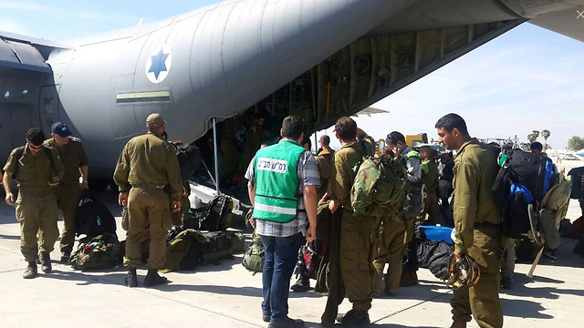
IDF soldiers bord military plane to Nepal. (Photo: Nepal)
A former high-ranking official in the Israeli aviation industry spoke to Ynet of the implications of this new development and warned that "the consequences of this thing are grave to say the least."
The new system enabled the average citizen to track a Gulfstream5 jet soar above Khan Younis in the southern Gaza Strip this week.
The Gulfstream5 is known as the "Nacshon," a term that refers to someone daring or courageous in Hebrew, because of it is used to collect intelligence signals and it operates as a radar plane – according to information found on the internet.
")
Nacshon jet, the kind that was identified over Khan Younis (Photo: IAI)
Another jet that could be spotted using the system this week was an Israel Air Force Boeing 707 – used for refueling and coined "Ram" in Hebrew. The plane made its way over southern Israel and spent significant time over the city of Arad.
"Although you cannot identify fighter jets using the system, (you can) without a doubt identify a military refueling plane fly towards distant destinations," said the aviation expert to Ynet. "This problem is known to Israeli authorities, who are trying to prepare in accordance in order to solve this issue."
The location of the aircraft can be identified using automatic transmission (ADS-B) which is used by 70 percent of civilian aircrafts today.
The planes receive their location by a navigation satellite and the signal that is sent back is then picked up by the recorder attached to the civil radar software. According to aviation professionals, by 2020, all civilian flights will be required to send out these signals.
As stated previously, the receivers can identify the location of planes, even those that do not operate with a satellite navigation system, which is how military planes can be exposed.
Using a system known as T-MLAT, planes can be identified using four or more receivers that get signals from a given plane and then uses the plane's estimated height and speed to calculate its location.
The IDF said in response: "We cannot elaborate on the Israeli Air Force but we will emphasize that the IAF's operations are not harmed by these sorts of applications."