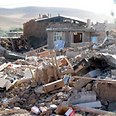
Iranian state TV said at least 40 people have been killed by a major earthquake that hit near the Iran-Pakistan border on Tuesday. Pakistani officials said the quake killed at least five people near the border.
Tremors from the 7.8 magnitude quake were also felt in India and Gulf states.
"It was the biggest earthquake in Iran in 40 years," said an Iranian official, who spoke on condition of anonymity.
Related stories:
- Ahmadinejad: Iran does not need atomic bomb
- Quake hits near Bushehr, 30 dead
- Iran says test-fired new land-to-sea missile in Gulf
The US Geological Survey said the quake hit at 10:44 GMT at a depth of 15.2 km (9.4 miles).
People in the city of Zahedan poured into the streets when the earthquake struck, Iran's Fars news agency reported. Many houses in rural parts of the region are made of mud brick, which can easily crumble in a quake, Fars said.

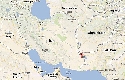
Quake's epicenter (Photo: Google maps)
All communications in the area have been cut, the Iranian Red Crescent's Mahmoud Mozaffar told state television. Rescue teams have been dispatched to the affected area, he said.
"In the aftermath of this earthquake five evaluation teams from the Khash and Saravan branches were sent to the area to assess damage," Mozaffar said.
The epicenter was in southeast Iran in an area of mountains and desert, 201 km (125 miles) southeast of Zahedan and 250 km northwest of Turbat in Pakistan, USGS said.

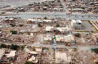
Devastation in Iran after last week's earthquake (Photo: Reuters)
Fars reported that the Iranian city of Saravan, which lies near the center of the earthquake, has not seen serious damage.
On April 9, a powerful 6.3 magnitude quake struck close to Iran's only nuclear power station, killing 37 people, injuring 850 and devastating two villages.
Most of Iran's nuclear-related facilities are located in central Iran or its west, including the Bushehr nuclear power plant on the Gulf coast. A US Institute for Science and International Security map did not show any nuclear-linked facilities in southeastern Iran close to Pakistan.
Ira sits on major geological faultlines and has suffered several devastating earthquakes, including a 6.6 magnitude quake in 2003 that flattened the city of Bam, in Iran's far southeast, killing more than 25,000 people.
This quake also shook tall buildings in India's capital New Delhi, sending people running into the streets, witnesses said. People also evacuated buildings in Qatar and Dubai, residents said.
"I was working and my work station was shaking," said Viidhu Sekhri, 35, an underwriter at a New Delhi insurance company. "Then it was a bit shaky so we just rushed outside."
Earlier in the day two smaller tremors were felt in India's Himalayan region close to the Chinese border.
An official at India's disaster management authority said the tremors felt in New Delhi and across northern India were because of the earthquake in Iran.
Reuters, AP contributed to the report
- Receive Ynetnews updates
directly to your desktop


