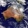
Sattelite image (Illustration)
צילום: רויטרס
High schools introduce 'Google Earth exams'
Education Ministry introduces new version of geography matriculation exam which will see students use Google's aerial and satellite footage
Israeli high school students taking the upcoming geography matriculation exam will be allowed to use Google Earth instead of an old fashioned atlas, Yedioth Ahronoth reported Tuesday.
The Education Ministry already partially computerized the high school geography final and its latest version includes a portion which require the use of Google Earth's aerial and satellite footage. A pilot program to that effect has been hailed a success.
Dalia Fanning, head of the Education Ministry Supervisors Department, who also oversees the geography program, said the computerized matriculation program has already garnered international interest and will be presented in the next International Geographical Society conference.
"Incorporating Google Earth in the final allows students to use interactive maps, observe geological layers and computer animation. It allows students to 'fly' over the area and 'land' according to the test's requirements."
The computerized final, however, can only be applied in schools that have computer labs. High schools lacking such labs will hold a regular, pen and paper test.
The Defense Ministry hopes that all Israeli high schools would eventually be able to apply computerized exams. Education Minister Gideon Sa'ar has recently introduced a program that would see each five students would share a computer in class.


