


Snow falls on Hermon Mount, power outages across Israel
Majdal Shams also experiences snow while heavy rain and strong winds batter the upper and western Galilee and the northern coastline; trees falling on power lines leave thousands in the dark.
The height of the storm is near: Heavy rain, accompanied by strong gusts of wind, have been battering the upper and western Galilee as well as the northern coastline area since the evening hours of Tuesday.
Snow has been mostly following on the Hermon Mountain, but light snow began falling in lower areas as well, such as Majdal Shams. Snow falling in the northern Golan Heights is expected to pile up overnight
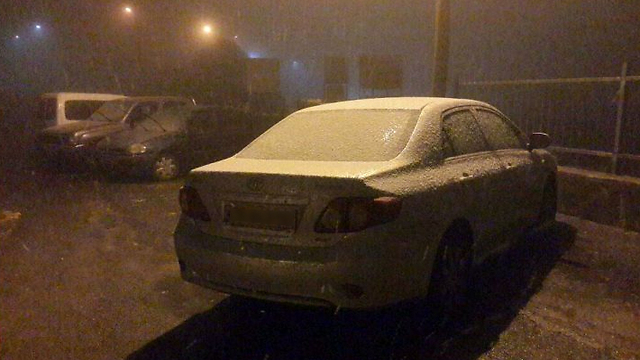
Hail has been pounding different areas of the upper Galilee and the road between Sasa and Bar'am has been covered with the white of soft hail.
Strong gusts of wind caused damages to the electricity system in Haifa and in the upper Galilee. Hanita Street in Haifa and different areas of the French Carmel were left in the dark after a tree fell on power lines. A short power outage was noted in Kibbutz Ami'ad as well. Israel Electric Company teams were working to restore power.
Thousands of homes were cut off from power in the Sha-Ariya neighborhood in Petah Tikva after a tree fell on power lines in the area. IEC teams were working to repair the power line.
The Police's Traffic Department has asked drivers of heavy vehicles to avoid driving on the two main access routes to Jerusalem - Highway 1 and Route 443 - in order to minimize traffic as much as possible in an attempt to avoid jamming the routes in case of severe weather. Police recommended all drivers avoid driving on the two routes, which are expected to be blocked ahead of the expected snowfall.
The forecast has already caused several municipalities and regional councils in the North to cancel school on Wednesday - including in Jerusalem, Kiryat Arba, Hebron, Efrat, the Gush Etzion communities, Beitar Illit, Mevaseret Zion and Mate Yehuda. In Ariel, school will end at midday.
Polluted air makes way to central Israel
Polluted air from southern Israel made its way to central Israel on Tuesday afternoon, ahead of a much anticipated winter storm which has led Israelis to hurry to supermarkets and stock up on necessary goods.
The Environmental Protection Ministry said the air pollution is expected to continue until Wednesday and recommended that heart patients, elderly people and pregnant women abstain from physical exercise.

Activity at Israel's various airports and sea ports have been limited due to the strong winds and haze. Winds were expected to reach 45-75kph on Tuesday and the sea was stormy, with waves reaching 4-6 meters high.
Starting midnight on Tuesday, snow will start falling at the top of the Galilee mountains as well, including in Safed, at an altitude of 600 meters or higher, and could pile up by morning.
On Wednesday, heavy snow will continue in the Golan Heights and Galilee mountains. During the morning hours, snow will gradually spread to mountains in central Israel and near noontime it is expected to reach Jerusalem as well and pile up for the rest of the afternoon. It might also snow at the top of the Negev mountains during the night.
Rain accompanied by thunder storms and hail will continue falling in northern and central Israel and will spread to the northern Negev in the evening. Flooding is one of the major concerns as the storm approaches as it is expected to cause the streams of central Irael and other areas to overflow. Furthermore, strong winds are expected to pursist and reach 45-65kph - with gusts reaching a maximum of 90kph.
In the south, sand storms are expected and could cause haze in central Israel, significantly limiting visability.

On Thursday, the snow will subside in the northern mountains of Israel. However, light snow or snow mixed with rain could fall in the mountains of central Israel. Local rain will continue falling from northern Israel to the central Negev, yet it will not be as strong as in the initial phases of the storm. Flooding will remain a concern for streams in eastern Israel yet winds are expected to weaken at this point, while temperatures will continue being significantly lower than average.
Finally, on Friday, light-to-moderate snow is expected to fall and possibly pile up in the early morning, mostly in the central Israeli mountains. Rain will continue to fall in central and southern Israel and temperatures will continue being lower than average.
Precipitation will resume on Saturday around noontime in northern and central Israel, accompanied by thunderstorms, gusts of wind and hail. In the evening, rain will spread to the south and Sunday's forecast is also predicted to include rainfall.
Noam (Dabul) Dvir, Roi Yanovsky, Shahar Hay and Ra'anan Ben-Zur contributed to this report.