Hitting Israel's national nature trail has never been easier
New maps in English and a revamped route aim to give non-Hebrew speakers a chance to see the country's mountains, forests, streams and parks up close and at their own pace
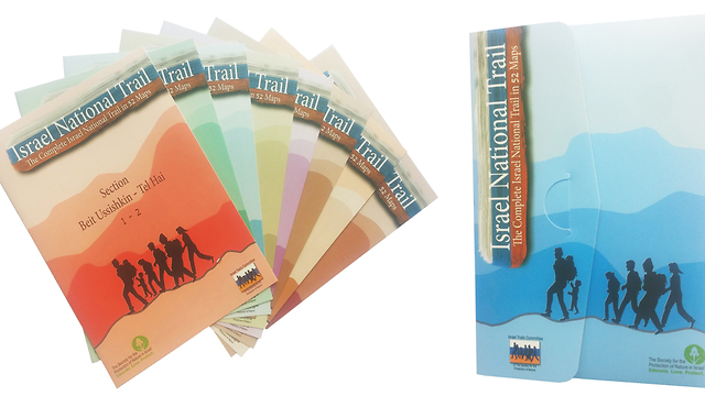
For the first time, the Society for the Protection of Nature in Israel (SPNI) is launching a special folder with 52 maps in English of the sections of the Israel National Trail – from Dan, near the Lebanese border in the far north of the country, to Eilat at the southernmost tip of Israel on the Red Sea.
Besides maps, the folder includes information in English about each section and the points of interest along it.

The new English folder is lightweight and easy to carry, and is suppose to make the navigation experience much easier.
"The need for maps in English came from the public, from tourists who arrive in Israel in order to hike," says Motti Ben-Shitrit of the SPNI department for marking trails. "We are delighted to make our beautiful nature more accessible for tourists who are not Hebrew-speakers."
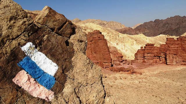
The Israel National Trail is about 1,070 kilometers long, and since its opening in 1995, thousands of travelers have hiked its path. The trail is marked with three stripes (white, blue, and orange), and takes an average of 45-60 days to complete.
According to statistics compiled in 2010, only four out of 10 hikers complete the entire trail. Recognizing this, the planners divided it into 52 smaller sections that can be hiked separately. Some sections can be completed in day trips or over the weekend.
In 2012, National Geographic magazine included the trail on its world's 20 most epic hiking trails list. It was praised for "connecting to something that often gets lost in all the headlines: the sublime beauty of the wilderness of the Middle East. It was described as a trail that "delves into the grand scale of biblical landscapes as well as the everyday lives of the modern Israeli."
After that, the number of foreigner tourists in the trail has grown. "That is why we've decided to produce this folder for the non–Hebrew speaking tourists. We came to realize that tourists want to hike on the trail, but find it hard because of the language," the SPNI adds.
The trail passes trough mountains, forests, villages, streams, springs, nature reserves and historical sites. Last year, the SPNI and the Survey of Israel (SOI) launched a website with 52 maps of the trial's sections available for free download. English maps are also available now for free at this website.
Since January 2016, the Israel National Trail has been available for exploration on Google Street View.
Click here for more information about purchasing the folder.


