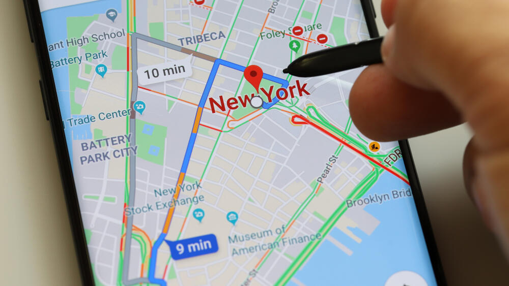
Google Maps is a top-rated navigation application, but did you know it has many hidden features? The following guide will help you become more familiar with the various tools offered by the service and make it even more useful.
More stories:
Private labels
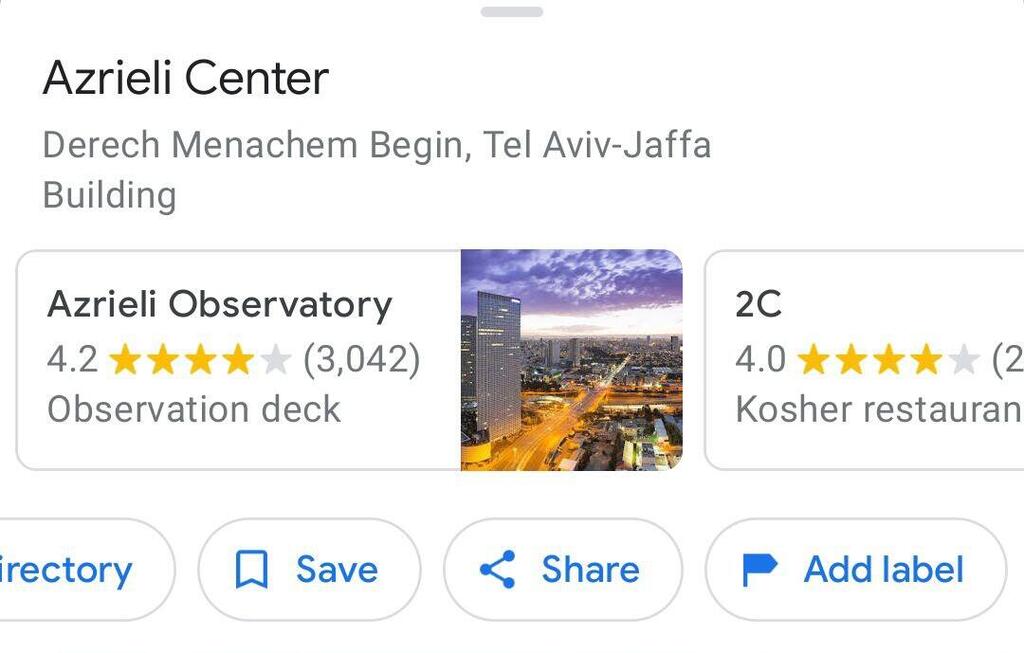
Let's start with a neat tip regarding places that you frequently visit or those that have personal meaning for you. You can also give them a private label. How can you do that? Enter the desired address. Scroll to the left in the options bar below the address and select "Add label."
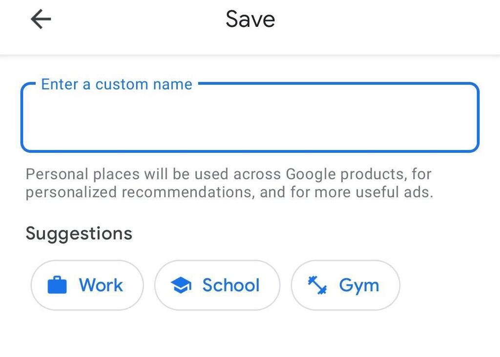
Now you can choose the desired name from the list of suggestions below, which includes options such as "Home" and "Work," or enter a name of your choice. The next time you enter the label name, the corresponding address will appear, making the navigation experience more intuitive.
Route with multiple destinations
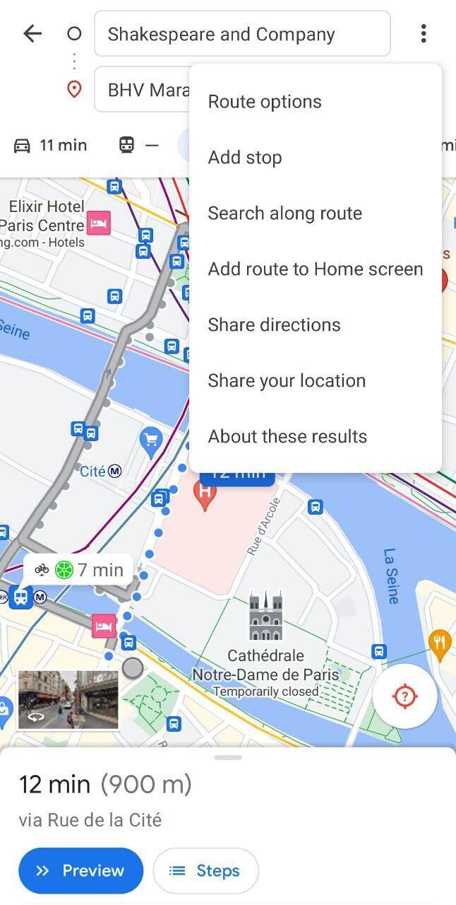
Google Maps also allows you to plan a route that includes multiple stops. After entering the starting point and destination in the route planner as usual, you'll notice three dots on the right side of the starting point. Tap on them and select "Add stop."
Now you can add an additional destination, with up to a total of nine points for the entire route. Want to change the order of the stops? Tap and drag the desired station by the two bars on its sides to the appropriate place in the route.
Finally, tap "Done," and you’ll see the route displayed on the map. Note that this option is available for driving, walking, or cycling routes, but not for using public transportation.
Want to know what’s nearby?
Under the app’s main search bar, you’ll see various buttons labeled "Restaurants" and "Parks" for different types of places you might be looking for in your area. Tapping on "More" will reveal additional options.
Another option is to type what you're looking for yourself in the search bar, for example, "ATM." You can browse through them in a list format or display them on a map that visually illustrates their locations and distances from you.
What to eat?
Looking for an eatery in the area? You can also use the previous tip to find it, but what if you want to understand not only the restaurant's location but also delve deeper and decide in advance if a particular restaurant suits your taste?
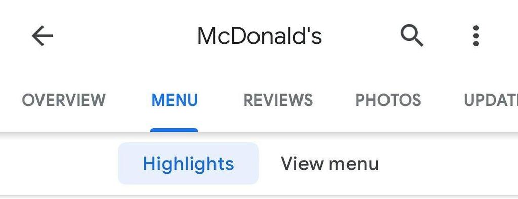
After selecting a restaurant from the list, you can see the rating given to it by users and even read reviews they left to get a first impression. You can also scroll down and choose the "Menu" tab. This tab will usually display two additional tabs – "Highlights," which will show user-uploaded photos of the restaurant’s dishes, and the "View menu" tab that appears on the right. Here, you will often find multiple pictures of the menu uploaded by Google Maps users who visited the restaurant.
Create lists
Another useful feature of Google Maps is the option to create a list and save different places in it. To do this, tap on the "Saved" tab on the main screen. Now scroll down until you reach the "Your lists" heading.
Choose "New list," then add a name and a description, and select who’ll be able to view it– choosing "Private" will create a list that only you can edit and view, choosing "Shared" will allow you to share it with others and allow them to edit the list, and choosing "Public" will make it public on the internet. Finally, tap "Save."
Now you can add places to the list. How do you do that? Type the name or address of the place you want to add. Once it appears on the map, tap on "Save" and select the name of the list you created. You can add a note describing the place and then tap on "Done."
To view the list with all the places you added to it, tap on "Saved" on the home screen and choose your list. The places will be displayed as a list with sections and also show up on the map. The map view is especially useful for trip planning – now you can see the different areas where all the places you want to visit are located and plan accordingly.
Alternatively, when you arrive in a specific location, you can open the list map and see which of the places you marked are found in your area. At any point, you can add items to your list.
Using Google Maps offline
Another good tip for planning trips is to download a map in advance that will be available to you for offline navigation when you're away from an internet connection.
To do this, enter the name of the city you want to download a map for, tap on its name once it appears in the search bar, select the three dots, and tap on "Download offline map." Now you can adjust the map’s radius using two fingers and tap "Download."
9 View gallery
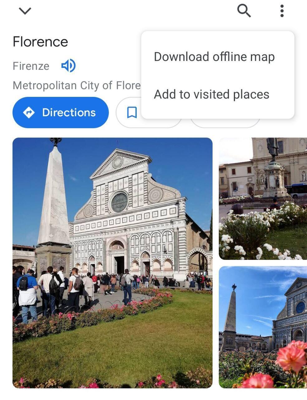

Download an offline map to help you find your way even without connection
(Photo: Screengrab)
To view the map, tap on your profile picture or the initial of your name appearing in a circle in the upper-left corner of the app. Tap on "Offline maps" and choose the relevant map. Tapping on the three dots next to it will allow you to update it.
Note that an offline map will show street names, but it won't offer all the functions the app provides when connected to the internet – for example, you won't be able to get directions for traveling on foot.
Create a timeline
Another option in the app is to view a summary of the places you’ve previously visited. To see this, tap on your profile picture or initial in a circle on the top-right corner of the screen. Choose "Your timeline."
Here you can select a specific day and see all the routes you took, and the places you visited, as well as a summary of the time and distance you traveled. Additional tabs above will summarize different trips and offer insights based on a monthly basis.
Want to delete your location history? Tap on the three dots next to the timeline title and go to "Settings and privacy." There you can choose to delete your location history and also define that such information should stop being collected about you.
The distance between two points
Let's finish with a feature that allows you to measure the distance between two or more points. To do this, long-tap on a point on the map from which you want to measure distance. Tap on the red pin that appears and choose "Measure distance."
9 View gallery
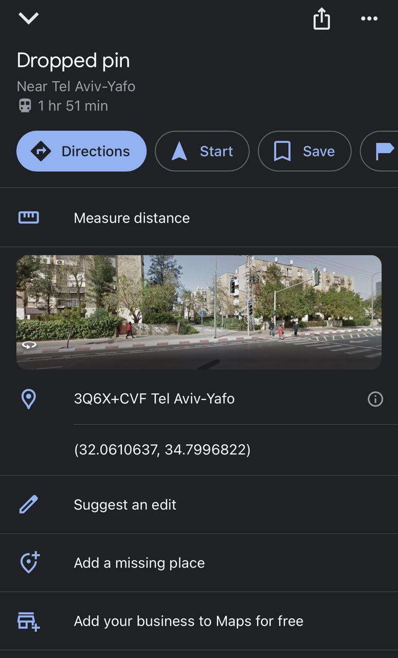

Tap on 'measure distance' to calculate how far two or more points are
(Photo: Screengrab)
Next, drag the map until the next point you want to measure the distance to appears and tap on it. The distance between the two points will be displayed below. If you want to add an additional point, tap on the plus sign that appears below that reads “Add point.”


