

Ahead of an unusually rainy weather system for the summer season, temperatures will dip slightly Friday in the mountains and inland areas. After the morning clouds clear, the weather will become fair and heat stress will ease.
On Saturday, skies will be partly cloudy with no significant change in temperatures. Local rain is possible in the north during the afternoon. Winds will strengthen, and during the night the rain is expected to spread to central Israel as well. Thunderstorms are also expected in the north, with a risk of flooding along the coastal plain.
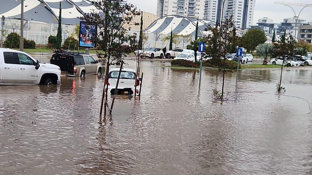
A fear of flooding along the coastal plain
(Photo: Israel Fire and Rescue, Central District)
The rain will continue on Sunday, from northern Israel to the northern Negev. Temperatures will drop significantly again and will be below seasonal averages. The rain is expected to stop only around midday, though drizzle is possible Monday morning. Temperatures will rise slightly at the same time but will remain below the seasonal average.
Forecast temperatures for Friday and Friday night: Jerusalem 23°C-33°C, Tel Aviv 25°C-32°C, Haifa 24°C-31°C, Safed 23°C-34°C, Katzrin 22°C-38°C, Tiberias 24°C-38°C, Nazareth 23°C-36°C, Afula 23°C-37°C, Beit She’an 26°C-4°C1, Lod 24°C-33°C, Ashdod 24°C-32°C, Ein Gedi 29°C-39°C, Beersheba 23°C-36°C, Mitzpe Ramon 24°C-36°C, Eilat 31°C-43°C.
Hail expected — and concern over what comes next
According to the Israel Meteorological Service forecast, the unusual weather will feature rain, at times heavy, along with lightning and thunderstorms. Hail is even expected along the northern coast, in the Haifa area and in the Sharon.
Dr. Amir Givati, director of the Israel Meteorological Service, said Thursday that “the rain is expected to be concentrated in the northern and central coastal areas, and could cause flooding because of the heavy intensity.”
Typically, the first significant rain of the season arrives only around October, and in some winters even later. The earlier arrival of rain this year also requires authorities to move up their preparations.
According to Givati, “the first rain of every season requires special preparation because of the dust, leaves and other effects that have accumulated over the summer — and this can affect urban drainage systems.”
The Yarkon Drainage and Streams Authority is preparing for the extreme rainfall. CEO Arik Leibovitz explained that drainage authorities across the country carry out engineering work to regulate streams and clear blockages, but a good urban drainage system can handle about 25 millimeters to 30 millimeters of rain per hour.
“Any amount beyond that could cause flooding,” he said, although in practice even smaller amounts of rain often cause flooding. According to Leibovitz, “the current forecast calls for about 30 millimeters of rain in the coastal plain, an amount very close to the system’s capacity threshold, which raises concern about flooding if the rain falls over a short period of time.”