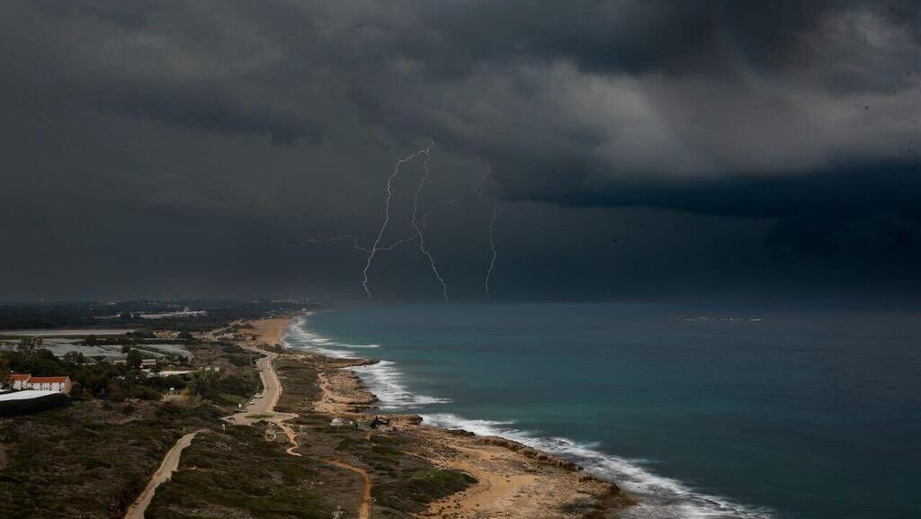
Winter is back — and in a big way. While intermittent rain fell Friday, mainly along the coast and in the valleys, a “full-fledged winter” is expected today, according to Israel Meteorological Service Director Dr. Amir Givati. This marks the start of a prolonged and significant rainy spell, arriving in several waves through Monday.
Rain is expected at intervals from the north through the northern Negev, with a risk of localized flooding in the southern coastal plain and the Gaza border area. From the afternoon, rainfall is forecast to intensify and spread to the Dead Sea region and the northern Negev, raising concerns of flash floods in streams. Winds will be blustery, with gusts of 50 to 60 kph, and isolated thunderstorms are possible.
Overnight, rain will continue intermittently from northern Israel to the northern Negev. Flooding remains a concern in the southern coastal plain, as well as flash floods in the Judean Desert and Dead Sea area.
On Sunday, rainfall will weaken and become more scattered, but temperatures will be colder than seasonal norms, with snow expected on Mount Hermon. Late Sunday night and into early Monday, rain will again intensify from the north to the northern Negev, continuing intermittently through the evening. Winds are expected to strengthen significantly, with powerful gusts of 80 to 100 kph.
Strong winds will also drive up Mediterranean Sea conditions, making it hazardous, with waves reaching 3 to 5 meters. There is a risk of flash floods in streams in the Judean Desert and Dead Sea area, as well as in westward-draining streams from the Judean Hills to the Mediterranean, including the Sorek, Lachish, Shikma and Besor streams. Conditions are expected to ease only on Tuesday.
On Monday, rain will mainly affect the north, central Israel and the northern Negev, with snow continuing on Mount Hermon. Rain will taper off from the afternoon, while haze is expected in the south. On Tuesday, drizzle to light local rain may still fall in the north and center.
Heavy flooding in Netanya this week
(Video: AP)
Police said that due to the stormy forecast, including the risk of flooding on southern roads, they may carry out preemptive closures. Roads cited include Route 234 near the Tsalim Bridge, Route 232 at the Shikma Stream, Route 40 at the Tzihor Stream, and Route 90 from Ein Gedi to the southern Dead Sea.
Police urged the public to plan travel in advance, avoid areas at risk from severe weather and exercise extreme caution, stressing the dangers of approaching flood zones, including the risk of falls, being swept away and drowning.
Rainfall totals on Friday were relatively modest. The highest amount was recorded at Ein Carmel, south of Haifa, with 11 millimeters. Herzliya and Merchavia near Afula recorded 8 millimeters, and Ashkelon 4 millimeters. No rain fell in Jerusalem or most areas south of it.
Forecast temperatures today and tonight (Celsius): Jerusalem 9–13, Tel Aviv 13–19, Haifa 14–18, Safed 9–12, Katzrin 10–13, Tiberias 12–17, Nazareth 11–14, Afula 12–17, Beit Shean 13–18, Lod 12–20, Ashdod 13–19, Ein Gedi 8–14, Beersheba 11–17, Mitzpe Ramon 8–13, Eilat 12–22.


