

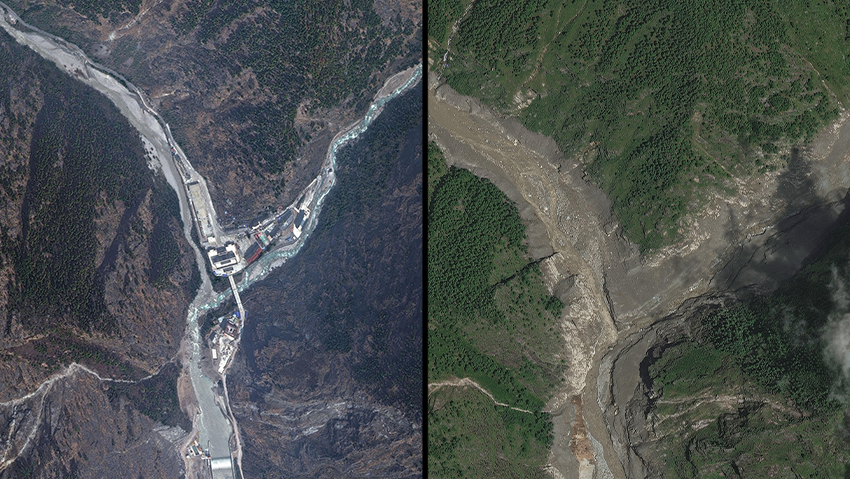
New satellite images from the Nepal-Tibet border region released Thursday evening offered an even starker view from space of the scale of the disaster. The border crossing, where viral footage showed a massive torrent surging through with extraordinary force, was completely buried in mud after being swept away. Satellite images also showed an entire town that had still been standing about a day earlier now largely erased.
"Powerful, strong, well-built buildings were wiped out like they were toothpicks," U.S. President Donald Trump said. Speaking to reporters at the White House, he said he had spoken with Nepal's leadership and offered "any help that they need."
Dramatic footage from Tibet: Massive flood sweeps away residents and vehicles
(Video: Reuters)


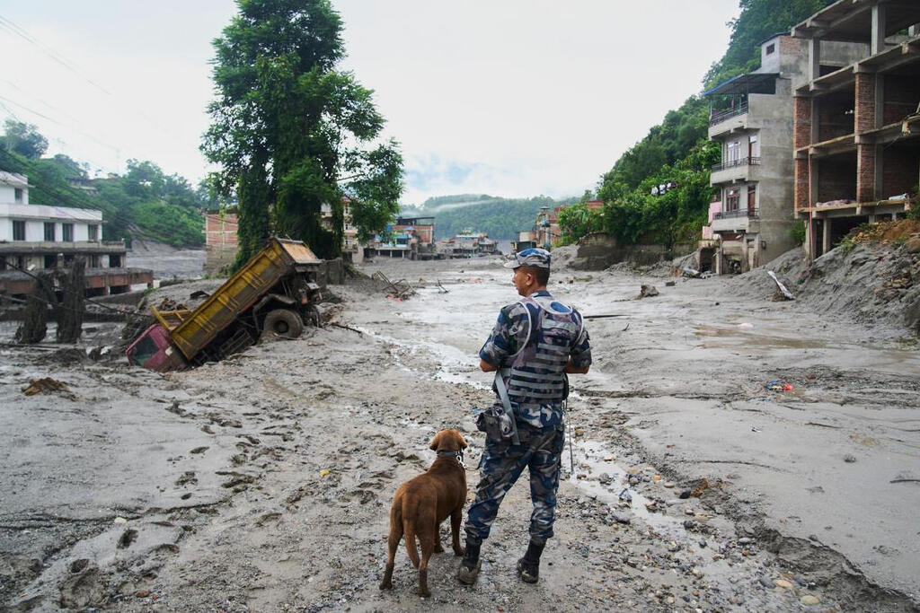
Rescue efforts, however, are unfolding under extremely difficult conditions. The enormous torrent tore away dozens of bridges and blocked more than 40 kilometers, or about 25 miles, of roads. Helicopters are now the only way to reach the area, and even they sometimes struggle to find suitable landing sites. The flooding also brought down electricity and communications infrastructure, leaving large parts of the disaster zone without power or internet access.
According to official figures released by Nepal and China, more than 390 people have been killed. More than 1,400 are missing, including hundreds of foreign tourists and pilgrims.
Among those missing in Nepal are 517 foreign nationals: 178 from India, more than 60 from the United States and 30 from other countries, including Ukraine, Britain, South Africa and Japan. One Israeli, a 60-year-old man, is also among the missing. In Tibet's Gyirong County, 558 people are listed as missing, including 260 foreign nationals.
The high number of tourists among the missing is partly due to the flooding in Syabrubesi, a starting point for the popular Langtang trek, as well as other areas used by travelers from India and the Indian diaspora making pilgrimages to Mount Kailash in Tibet, a sacred site for Hindus.
Asmita Dahal, a Kathmandu resident, told CNN she was waiting anxiously for news of her 21-year-old brother, Suman, who works for a company that transports pilgrims to the mountain.
"We're hoping for a miracle. We are worried his bus might have been swept away in the flooding, we just don’t know" she said.
Sagar Pandey, the CEO of a Himalayan tourism company, flew over the area by helicopter and later told Reuters: "There are no human-made things, no human settlement left. Everything is just flat. So anyone in the hotel, the restaurant, or the car, I believe that everybody is gone."
Vasanthi, whose sister Venila was part of a pilgrimage group from Malaysia, heard from her after she crossed from Nepal into Tibet. Contact has since been lost.
"I'm totally broken, I really want her to come back. I don’t have anyone but her. I just want her to come back home. I want her to be safe," she said.
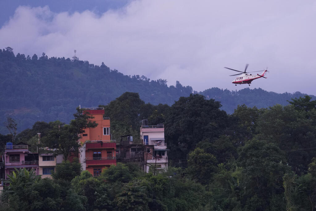
Helicopters struggle to land
(Photo: Rajesh Kumar Singh/AP)
(Photo: Niranjan Shrestha/AP)
(Photo: Niranjan Shrestha/AP)
The disaster's impact has also reached Nepali communities around the world, where relatives of the missing are closely following every update.
Pema Gurung, who owns a Nepali restaurant in New York, told CNN he had lost all contact with relatives in the region.
"In my mind and in my heart, I’m hoping my friends are alive," he said.
Rojina, who lives in Ottawa, Canada, learned that the town where she was born had been completely washed away.
"Everybody I knew – my friends, my relatives, my community – everybody was looking," she said.
Janak Bahadur, who survived the flooding at one of the pilgrimage sites, told Reuters that "The river looked small from a distance but it suddenly started overflowing and swept through."
He summed it up in a single sentence: "It came in suddenly and exploded like a bomb."
The disaster along the Nepal-Tibet border occurred Wednesday at about 9 a.m. local time, when an enormous mass of ice, rock and mud collapsed into the Lende Khola River, a tributary of the Bhote Koshi along the Himalayan border.
The collapse caused the river to overflow and sent a powerful torrent downstream, triggering devastating floods on both the Nepali and Tibetan sides of the border.
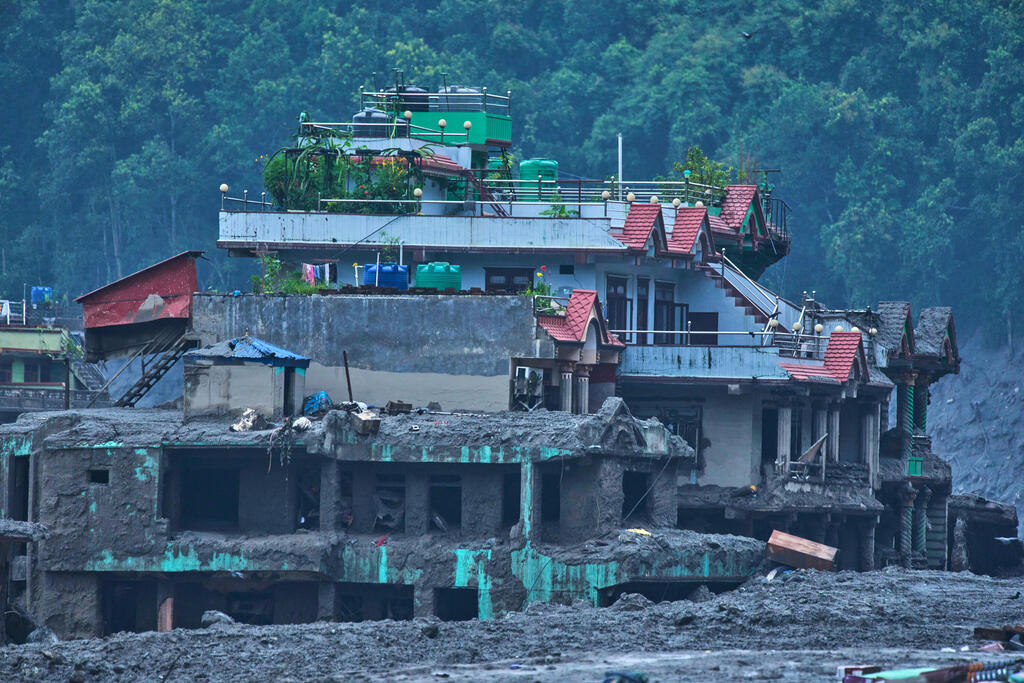
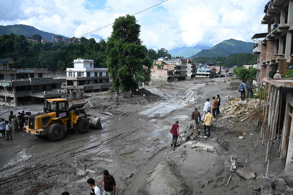
Images and videos from the region showed a violent wall of water racing downhill, tearing bridges from their foundations and collapsing homes with people still inside.
One particularly viral video, recorded by a security camera on the Tibetan side of the China-Nepal border crossing in Gyirong County, showed people spotting the massive torrent racing toward them and trying to flee. Moments later, the water burst through with tremendous force, sweeping between buildings, parking lots and access roads and burying or carrying away everything in its path. Buses and cars were overturned, crushed and reduced to wreckage.
Civilization wiped away
Chinese reports said Thursday evening that rescue teams had still not reached the border-crossing area in Gyirong County. Crews were working to clear the main access road leading to the site.
The crossing is considered an important hub in China's Belt and Road Initiative, and parking areas and logistics facilities have been built there over the past decade.
Every structure in the border complex, including the main border gate — an imposing building bearing China's national emblem and housing customs and immigration agencies — was completely destroyed.
The entire site was covered in a thick layer of mud and, according to reports in China, almost no trace of civilization remained.
The day after the disaster in Nepal, seen from a drone
(Video: Reuters)
Chinese government geologist Guo Zhuocheng said the debris flow was moving at about 50 meters, or 164 feet, per second, leaving people almost no time to react.
In the first hours after the disaster, geological institutes reported that a magnitude 4.4 earthquake had struck the area about seven minutes before the flood and raised the possibility that it had triggered the catastrophe.
But the U.S. Geological Survey later said the shaking initially identified as an earthquake was actually seismic energy generated by a landslide above the surface, rather than the other way around. The energy from the collapse was equivalent to a magnitude 5.2 earthquake.
Experts examining satellite imagery from Planet Labs said the deadly flash flood was likely triggered when the lower section of a glacier broke away and crashed onto the valley floor about 1 kilometer, or 0.6 miles, below, sweeping up huge amounts of rock and sediment along the way.
It remains unclear what caused the glacier to collapse.
Earth scientist Dan Shugar, an associate professor at the University of Calgary who examined the Planet Labs images, told Reuters that the satellite imagery appeared to show a large amount of snow had melted in the 24 hours before the disaster.
"Some of the glaciers in the valley were covered in snow yesterday and today they are mostly bare ice. So in other words (and I haven't seen any weather station data yet), it was probably warm," he said.
Shugar said the disaster occurred after a block of ice about 600 meters, or nearly 2,000 feet, wide suddenly broke off and plunged to the valley floor.
"The bottom looks like a bomb exploded — it's just deposits from the broken-up glacier," he told The New York Times.
(Photo: Prakash Mathema and Prakash Mathema / AFP)
Bishal Nath Upreti, a geologist and academic at Tribhuvan University in Kathmandu, described the event as "one of the biggest disasters Nepal has ever experienced."
He said the collapse created "a tsunami from the sky," releasing about 20 million cubic meters of excess water.