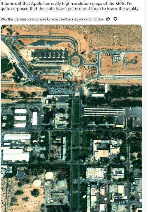
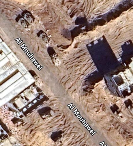
Aerial photographs of the Dimona Nuclear Research Center, classified military bases and images from Gaza showing IDF maneuvering units are now publicly accessible via Google and Apple map services. Recent posts on X and other platforms reveal that the resolution of these images is relatively high compared to what was previously available, reaching 0.4 meters.
The availability of such high-resolution satellite images on major mapping platforms transforms them into a significant open-source intelligence resource for hostile entities, researchers or even curious individuals. This development stems from changes in global satellite imaging capabilities and regulations.
In 1997, the U.S. enacted the Kyl-Bingaman Amendment, which restricted the collection and distribution of high-resolution satellite images of Israel and territories under its control unless approved by a federal authority. At the time, most commercial satellite imagery came from American companies, and the law directly resulted from Israeli diplomatic efforts in Congress.
Availability of such high-resolution satellite images on major mapping platforms transforms them into a significant open-source intelligence resource for hostile entities
However, the situation has changed dramatically. By 2017, the U.S. National Oceanic and Atmospheric Administration (NOAA) determined that non-U.S. satellite imagery had surpassed the resolution of American satellites. This allowed mapping and navigation services to access high-quality images of Israel from non-American sources.
In 2018, a study by Oxford University archaeologists Andrea Zerbini and Michael Fradley demonstrated that high-resolution satellite images of Israel, exceeding 2 meters, had been available for years from companies like Airbus and South Korea's Kompsat, which offered images with a resolution of 0.4 meters. As a result, in 2021, the U.S. government approved the sale and publication of images with resolutions up to 0.4 meters on mapping platforms.
<< Get the Ynetnews app on your smartphone: Google Play: https://bit.ly/4eJ37pE | Apple App Store: https://bit.ly/3ZL7iNv >>
For over three years, obtaining high-quality images of classified sites in Israel has been relatively easy, including the Dimona Nuclear Research Center and strategic bases not concealed underground. Some satellite images have even captured Israeli aircraft activity, such as F-15s, over Gaza and Lebanon, as well as maneuvering ground units.
This situation appears to be uncontrolable. The Israeli government has little influence over the publication of such images by commercial American entities, as long as they comply with the Kyl-Bingaman Amendment. Unlike in 1997, numerous global online services now offer satellite images for purposes ranging from navigation and mapping to commercial uses like mining, agriculture, urban planning, and research. The absurdity of the situation was highlighted in 2021 when foreign sources reported significant construction at the Dimona Nuclear Research Center—an event that would have been unthinkable in the past.
The question now is how the state is addressing it. Based on the Defense Ministry and IDF spokesperson’s refusal to comment, it appears the chosen approach is to ignore the problem—a strategy that has proven ineffective in recent years when dealing with security challenges.


