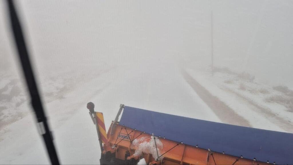
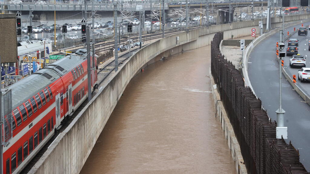
As Storm Byron rages, bringing heavy rain across Israel, snowfall was reported overnight on the high‑altitude positions of Mount Hermon. The storm is due to strengthen Wednesday, with a forecast peak overnight and into Thursday, when the rain intensifies and flash‑flood risk rises.
The IDF decided to release soldiers stationed at remote outposts in the south Wednesday instead of Thursday to ensure safe return home amid the worsening weather. Storm‑proof suits will be distributed across units, especially in Gaza and northern sectors.
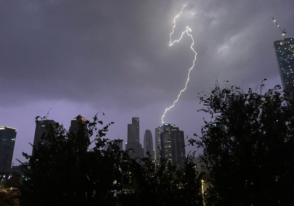
Lightning in the sky as seen from the cockpit
(Photo: Idan Eilat, from Instagram page elalpilots)
Troops in the field have been issued winter gear, and the IDF is evaluating tactical readiness for low‑visibility, heavy‑rain and fog conditions. The chain of command is ensuring continuity of navigation and mobility despite flooding, mud, snow and extreme cold.
Corporal Kfir Sabag, a career soldier stationed on Mount Hermon, spoke in an interview with ynet about the first snow that has fallen there. “Today winter finally began in earnest — I think if you look around, you see snow coming up,” he said, with the white landscape visible behind him. “Thank God, we’ve been waiting for this moment.”
He added that “the snow has accumulated on the upper‑line positions of the posts, not yet at the base. I hope that by next week forecasts will improve, we’ll get snow also down there, the base will open, civilians will come and we can live up north like normal.”
Describing the site, he said: “I think this is the most beautiful place in the country and the most fun to serve in.” He noted that he’s stationed at 2,100 meters altitude, in 2°C temperatures. About his service, he added: “There are forces, there are posts that the IDF built, people sitting there. I won’t tell you what we do every day, but we are ready, we guard the front line.”
Meanwhile, the national civil‑defense command is coordinating with local emergency agencies to monitor flood‑prone areas and prepare for possible evacuations or rescues as needed. Rescue‑unit readiness will be scaled depending on evolving weather and police requests.
According to the Israel Meteorological Service (IMS), Storm Byron has already dumped heavy rainfall on coastal regions. An “orange” alert has been issued for significant rain Wednesday in Carmel, the northern, central and southern coastal plain, and the Judean Foothills until 10 p.m. Expected rainfall totals: 50 millimeters–75 millimeters.
6 View gallery


Lightning from Storm Byron sparks a fire in Tel Aviv
(Photo: Fire and Rescue Services)
Netivei Israel, the national transport infrastructure company, announced an elevated state of readiness ahead of the height of the storm, following warnings from the Israel Meteorological Service. As part of its preparations, the company has reinforced field crews and positioned heavy equipment at strategic locations along major traffic routes to respond rapidly to any scenario and reduce risks from the severe weather.
In addition, the company said it is operating an advanced network of flood‑sensors in southern Israel’s wadis, or river beds. The system enables early detection of rising water levels, triggers immediate alerts and automatically lowers road barriers and activates warning signage at stream‑crossings on flood‑prone roads.
Alon Geva, head of the Central Region for Operations and Maintenance at Netivei Israel, said: “We call on drivers to exercise heightened caution, heed instructions and avoid flooded areas. Please report any hazard to 2120.”
Local authorities are also issuing safety guidance. Herzliya Mayor Yariv Fisher told Ynet that residents in risk‑areas — such as ground‑floor apartments or basements — should avoid unnecessary risk.
“If you see a flooded road, don’t drive into it. If there’s an electrical problem, stay away. And if you live nearby — clear the roof and gutters, make sure drainage paths are open,” he urged. Accepting that the drainage infrastructure has limits, he added: “We know we can handle up to 24 millimeters per hour. Beyond that, we know certain areas in the city are very vulnerable — that’s where we are ready.”
Koby Mashita, a station fire chief in Haifa, recalled the fatal 2020 Tel Aviv flooding caused by a burst elevator pipe, advising citizens against entering underground garages or using elevators during heavy rain. He said such behavior “is unnecessary and life‑threatening.” His strong recommendation: “Stay alert to your surroundings and don’t enter flooded areas or basements. If in doubt, don’t risk your life.”
Since midnight, rain has fallen from the northern border to the Negev Junction in the south. The highest amount recorded between midnight and 6:00 a.m. was at the station in northern Tel Aviv — 33.6 mm over six hours. In southern Tel Aviv, 25 mm was measured; the station at Beit Dagan recorded 22.9 mm; and Rishon LeZion 22 mm. Heavy rain also fell overnight in the Zikhron Ya‘akov area — 25.6 mm — making it the top location in the country over the past 24 hours, with a total of about 77 mm.
Rainfall over the past 24 hours included: Zikhron Ya’akov 77.5 mm, Atlit 68.4 mm, Haifa (Technion) 60.9 mm, North Tel Aviv 38.9 mm, Rishon LeZion 34.4 mm, Hadera 31.5 mm, Petah Tikva 26.2 mm, Mevo Beitar 21.9 mm, Dorot (near Sderot) 19.3 mm, Karmiel 19.1 mm, Mount Harcha (Binyamin hills) 18.4 mm, Sakhnin 18.0 mm, Ashkelon 17.9 mm, Nazareth 16.8 mm, Ashdod 15.4 mm, Safed 15.3 mm, Beit Dagan 22.9 mm, Ra’anana 23.6 mm, Southern Tel Aviv 25 mm, Zikhron Ya’akov (overnight) 25.6 mm, Jerusalem 10.8 mm, Kiryat Shmona 11.6 mm, Tiberias 7.7 mm, Tzemach 6.1 mm, Beersheba 3.4 mm.
The rain expanded overnight to Jerusalem: the central station registered 10.8 mm since midnight; Mevo Beitar had 21.9 mm; and on Mount Harcha in the western Binyamin hills 18.4 mm. In the Kinneret region, 4.6 mm fell in Tiberias and 6.1 mm in Tzemach (south of the lake).
In the last few hours, rainfall has been concentrated along the northern coast: in Hadera about 9 mm, Zikhron Yaakov 12 mm, Ein Carmel 11.4 mm, Kerem Maḥerel (Carmel) 8.8 mm, and Haifa 8 mm.
The storm’s peak is expected overnight between Wednesday and Thursday and through Thursday. Heavy rain and thunderstorms are forecast from the north down to the northern Negev. The coastal plain and Judean Foothills face serious flood risk, with expected intensification of rainfall, including in Jerusalem and the Negev by Thursday afternoon. Flash‑flood danger in the Judean Desert wadis and the Dead Sea area is also forecast, while parts of the southern Negev may see isolated rain. Temperatures will remain well below seasonal norms.
Byron will remain with Israel into Friday; flooding and flood warnings will persist. Rainfall will gradually weaken, but rain and local storms may continue. Temperatures will rise slightly but remain mild for the season; isolated thunderstorms may still occur. Conditions will begin to stabilize over the weekend, with lighter rain in the north and center, but mostly dry weather expected.
Today’s forecast (day & night):
Jerusalem 9°C–15 °C (48°F–59°F), Tel Aviv 13°C–19 °C (55°F–66°F), Haifa 14°C–16 °C (57°F–61°F), Safed 9°C–12 °C (48°F–54°F), Sea of Galilee 13°C–17 °C (55°F–63°F), Eilat 14°C–20 °C (57°F–68°F).


