

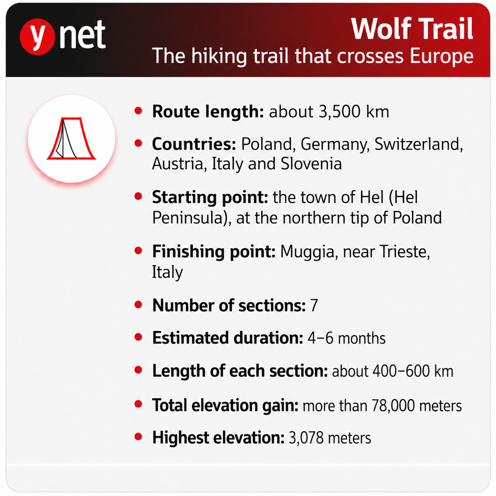
A new nearly 3,500-kilometer walking route aims to become one of Europe’s longest and most prominent hiking trails. It begins on the Baltic Sea coast in northern Poland and ends thousands of kilometers to the south in Muggia, Italy, near Trieste and the Adriatic Sea. Along the way, it crosses six countries and passes beaches, forests, lakes, mountain ranges, Alpine passes and picturesque towns.
The starting point is at the tip of the Hel Peninsula, a narrow strip of land jutting into the Baltic Sea, and the endpoint is in Muggia, an Italian port town south of Trieste. Those who choose to walk the entire route will have to cover about 3,500 kilometers and accumulate about 78,000 meters of elevation gain — nearly nine times the height of Mount Everest, in cumulative terms. According to experts who examined the route, the full journey is expected to take four months to six months.
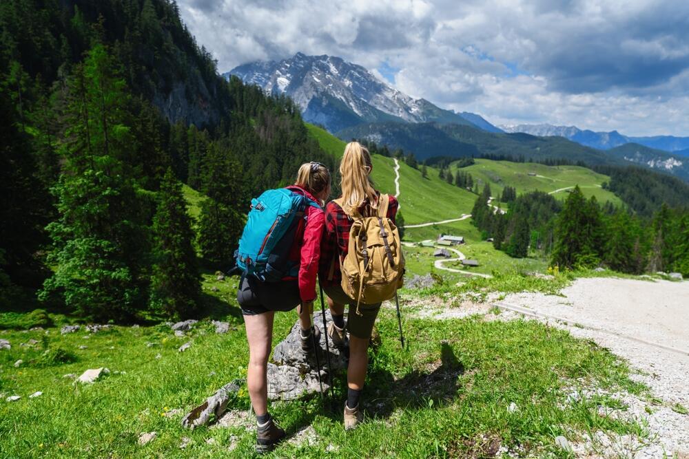
The Wolf Trail is a new route, but not a trail that has been newly cut and marked along its entire length. German outdoor gear company Jack Wolfskin connected thousands of kilometers of existing hiking trails, forest roads and long-established European routes under one name, creating a single continuous, mapped route that links northern Europe with the Adriatic Sea.
The route and scenery: Where does the trail go?
The route was designed so that, in general, the difficulty and elevation increase as hikers progress south. The first weeks pass along flat beaches, port cities and plains in northern Poland and Germany. Later come the low mountain ranges of central Germany, vineyard areas and the Black Forest. Finally comes the sharp change: the crossing of the Alps, the Dolomites and the Julian Alps. The seven sections are not merely a technical division of the distance — each has a different route, pace and character.
According to estimates, completing a single section is usually expected to take between two weeks and four weeks, and at many points it is possible to enter and leave the route for shorter hikes as well. The company publishes a digital map and GPX files, but because the Wolf Trail connects existing trails, hikers should not assume there is new, uniform field marking carrying its name along all 3,500 kilometers. Hikers are required to check the local markings and the current condition of the route in each area separately.
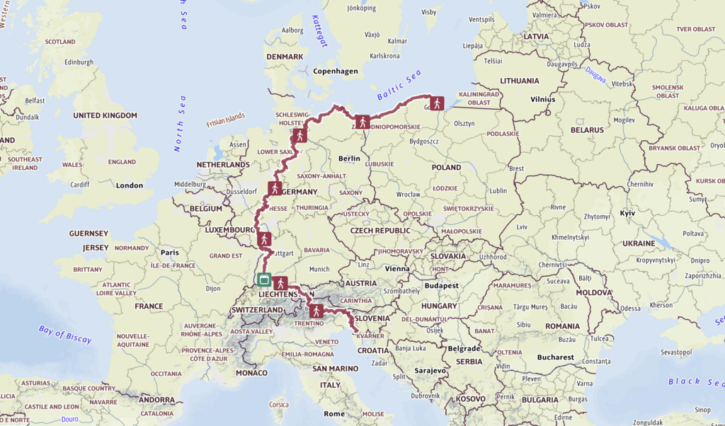
The path of the Wolf Trail
(Photo: jack-wolfskin.com)
As of July 2026, the sixth section — and therefore the overall route as well — is marked on Outdooractive as closed. The platform applies such a status automatically when part of the route is affected by a local closure. Since the situation may change, it is recommended to check the route’s current status before setting out.
Section 1: Between shifting dunes and the Baltic Sea beaches, Poland
The first section begins in the town of Hel at the end of the peninsula of the same name, and continues west to Świnoujście, near the German border. This is the flattest part of the route, with relatively moderate climbs.
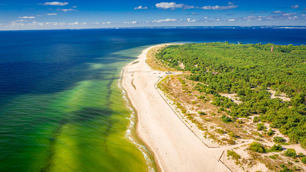
Hel Peninsula, Poland
(Photo: Shaiith/Shutterstock)
The path moves between sandy beaches, pine forests and resort towns scattered along the Baltic Sea. One of the most notable areas along the way is Słowiński National Park, known for its shifting dunes — sand hills that gradually change location under the influence of the wind. Although this section is technically comfortable, prolonged walking on exposed sand, sometimes against the sea wind, creates a different kind of challenge: less climbing, more distance and endurance.
Section 2: The port cities and lakes of the north, Germany
After crossing the border, the route enters the island of Usedom and begins its second section. Here too, the terrain remains mostly moderate, but the Polish coastline gradually gives way to the landscape of northern Germany: lagoons, lakes, agricultural areas and historic port cities.
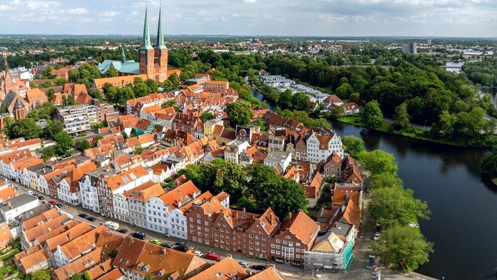
Town of Lübeck, Germany
( Photo: Snapshot freddy/Shutterstock)
The route passes through Mecklenburg and among the Hanseatic cities, including Rostock and Wismar, which were part of northern Europe’s maritime trade network in the Middle Ages. Unlike the image of a trek disconnected from the inhabited world, this section combines nature trails with promenades, urban streets and roads between villages. Toward its end, it leaves the sea, turns inland and continues toward the Elbe Valley and the town of Geesthacht, southeast of Hamburg.
Section 3: Where the plains begin to rise, Germany
The third section, from Geesthacht to Marsberg, marks the beginning of the topographical change. The route is still not Alpine, but the climbs become more significant as it moves away from the northern plains.
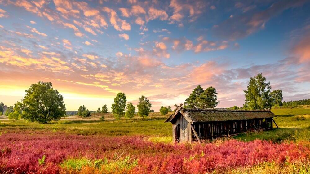
Lüneburg Heath, Germany
(Photo: Sina Ettmer Photography/Shutterstock)
The trail crosses the Lüneburg Heath, a landscape of heather shrubs, groves and open areas that turn purple during the flowering season, and continues south through forests, lakes and hills. As the route moves farther from the northern plains, the trails become more rolling and the first ridges begin to appear. There are still no high mountain passes or technical climbing sections here, but this is the point where the trek stops feeling like a long walk along the coast and begins to take on the character of a mountain journey.
Section 4: Forests, ridges and the road to the vineyards, Germany
In the fourth section, the route already enters Germany’s low mountain ranges, along the way from Marsberg to Bad Dürkheim. This section is longer and more demanding than the previous ones, mainly because of a continuous sequence of ascents and descents.
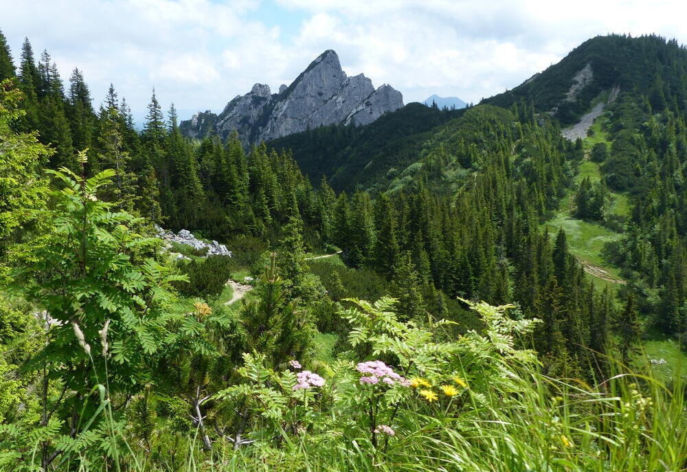
Rothaar Mountains, Germany
(Photo: guentermanaus/Shutterstock)
The trail passes through the Rothaar Mountains and around Winterberg, among forests, valleys and small villages, and connects to existing high-altitude trails that cross several nature parks. The difficulty does not come from one exceptional peak, but from the cumulative climbs and descents along the way. In its southern part, the landscape changes again: the forests open up, the vineyard slopes of the Palatinate region appear along the route, and the trail reaches Bad Dürkheim, a spa town also known for its wine tradition.
Section 5: From the vineyards into the depths of the Black Forest, Germany
The fifth section leaves Bad Dürkheim and first passes through the Palatinate Forest, among reddish sandstone formations, castles and wine villages. It continues through Neustadt on the Wine Route, Annweiler and Bad Bergzabern, approaches the French border and then turns east toward Karlsruhe.
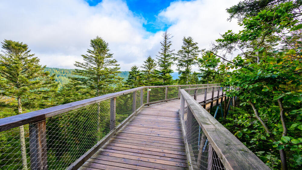
Black Forest, Germany
(Photo: Simon Dannhauer/Shutterstock)
After the short urban passage, the route enters the Black Forest through Pforzheim and crosses it from north to south. Here, valleys, spruce forests, lakes and long ridges cluster together. The route also climbs to Feldberg, the highest point in the Black Forest, and continues through the Schluchsee lake area. The section ends in the city of Konstanz, on the shore of Lake Constance and at the foot of the Alps.
Section 6: Gateway to the Alps, Switzerland, Austria and Italy
Lake Constance is the dividing line between the two parts of the route. North of it, most days pass through flat terrain or low ridges. South of it, the crossing of the Alps begins.
The sixth section passes along parts of the lake shore, enters Switzerland and Austria and continues through the Allgäu Alps and Tyrol to South Tyrol in northern Italy. The climbs here are already much steeper and longer than those in the northern part of the route.
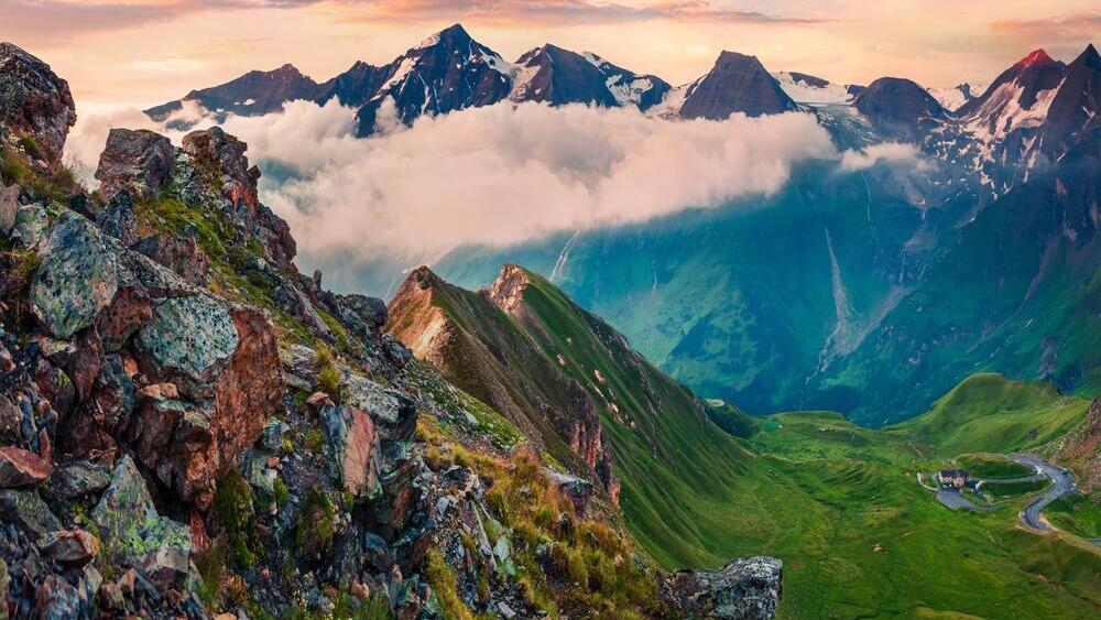
The Austrian Alps
(Photo: Andrew Mayovskyy/Shutterstock)
The route proceeds through inhabited valleys, meadows, forests and mountain passes before continuing toward Bolzano in South Tyrol. This is also the stage at which weather and snow conditions begin to determine whether a given pass is open, not only how many kilometers a hiker can complete in a day.
Section 7: Through the Dolomites to the Adriatic Sea, Italy and Slovenia
The seventh section is the longest, steepest and most complex part of the route, and it contains a significant share of the total elevation gain along the Wolf Trail. The path leaves the Bolzano area, crosses the Dolomites and passes among limestone ridges, valleys and passes that may reach elevations of 2,500 meters to 3,000 meters. From there, it continues east to the Julian Alps and Slovenia.
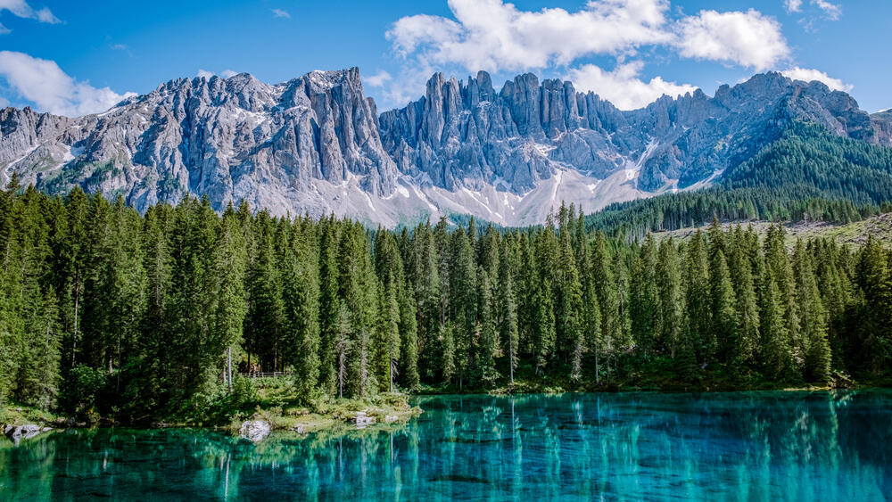
The Dolomite mountains
(Photo: fokke baarssen/Shutterstock)
Later, the long descent begins from the Alpine area to the Karst Plateau and the milder climate of the Adriatic coast. The endpoint is in Muggia, a small port town south of Trieste, where the route that began months earlier on another coast, in northern Poland, comes to an end.
Setting out: How does it work?
Although the route’s website says parts of it are suitable for beginner hikers, completing the entire Wolf Trail requires experience, planning and a high level of physical fitness. The difficulty is not uniform: The first sections are relatively flat, but their length requires daily walking for weeks.
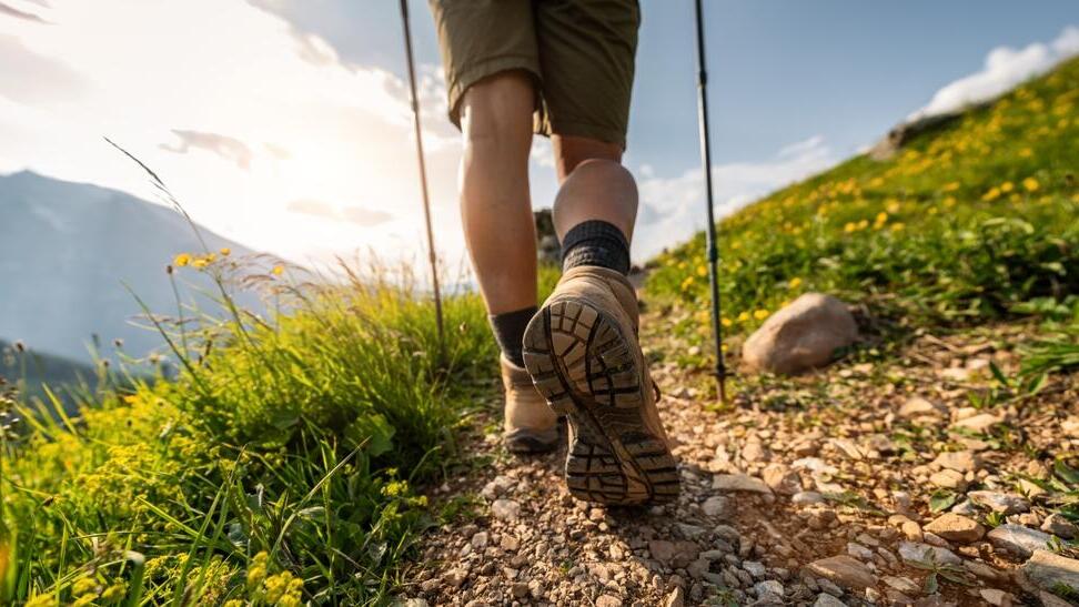
Hiking in the German Alps
(Photo: r.classen/Shutterstock)
In the southern sections, sharp climbs, narrow trails, Alpine stretches and passes at elevations of up to about 3,000 meters are added. To this must be added carrying gear, weather changes, cumulative fatigue and the need to find food and lodging every day. Therefore, even someone who can complete short mountain treks is not necessarily ready for a continuous journey lasting several months.
Of course, it is not necessary to set out on a half-year journey. Although the route connects northern Europe with the shores of the Adriatic Sea, each hiker can choose the starting point, the length of the journey and the place where it ends.
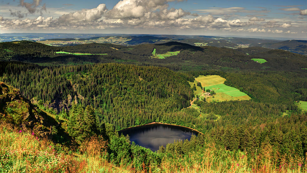
Black Forest, Germany
(Photo: Shutterstock)
To make the route accessible to hikers, Jack Wolfskin uploaded it to Outdooractive, a website and app for planning and navigating outdoor trips. For each of the seven sections, detailed maps, distance and elevation data, and GPX files are available for download to a phone or smartwatch.
Because the Wolf Trail connects existing trails, hikers should not assume that a new, uniform field marking carrying its name exists along the entire route. They must also rely on local markings and check the current condition of the route before setting out. As of July 26, 2026, the sixth section — and therefore the overall route as well — is marked on Outdooractive as closed, due to a closure affecting part of the way.