


Documents obtained by ynet following the death of schoolboy Yair Wilensky in an unexploded munition blast on Ramim Ridge in northern Israel reveal troubling questions about how school hiking trips are approved in areas damaged by war. The Education Ministry's trip coordination center authorized an itinerary labeled "Israel Trail 2051," a designation that combines the names of two entirely different routes running parallel to each other, one of which remains officially closed. The documents raise concerns about unclear instructions and conflicting restrictions in a region exposed to Hezbollah fire for more than two years.
Near the entrance to Kibbutz Kfar Giladi, two separate hiking routes begin at roughly the same location. One is the Israel Trail, marked in orange, blue and white, which climbs dozens of meters up the mountainside. The other, marked in green, is a paved route identified on maps as Trail 2051, also known as the Ramim Ridge Scenic Road or the Naftali Mountains Scenic Road. For approximately 7.5 kilometers, the two trails remain entirely separate before merging near Ein Korim spring and continuing toward Mishkenot HaRoim.

The school group received authorization to hike from Kfar Giladi to Mishkenot HaRoim along a route identified as "Israel Trail 2051." Yet the same approval explicitly stated that "Ramim Ridge Scenic Road 2051" was closed due to repairs of war damage. The Jewish National Fund (KKL-JNF) website also lists the paved, green-marked route as closed to hikers.
The scenic road was repaired and remarked only during the past week but has still not officially reopened. Nevertheless, thousands of families walked along it during the recent Jewish holidays and the vacation period at religious educational institutions. Despite the risk of unexploded ammunition and other remnants of the fighting, no specific warnings about such dangers were posted along the route. A longstanding KKL-JNF sign states that the trail is closed "due to war damage" and that hiking is "strictly prohibited," but makes no mention of unexploded ordnance.
‘The trail is approved, but not approved’
Investigators now face several critical questions. Did the students take the green-marked scenic road rather than the Israel Trail? If so, why? Did the guide misunderstand the route or fail to distinguish between two trails beginning at the same location? Did the group follow the approved itinerary, or was the route changed along the way? Another question concerns the approval system itself: Should school trips be authorized near routes that remain closed because of possible unexploded munitions left behind by the war?
Experienced hiking guides have sharply criticized the Education Ministry's approval procedures, arguing that the conflicting instructions indicate a lack of understanding of conditions on the ground. "It cannot be that Route 2051 is approved, but approved with restrictions. So is it approved or not?" a senior hiking guide told ynet. "If these are different routes, they should have been treated as different routes."
The guide acknowledged that the person leading the trip also had a professional responsibility to clarify the instructions. "Perhaps he should have asked questions and tried to understand what the coordination center meant with all its 'remarks,'" he said. "But ultimately, the body responsible for overseeing and managing the entire process is the Education Ministry."
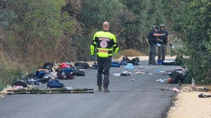
Scene of the blast
The central problem, according to guides familiar with the area, is the disconnect between officials issuing hiking permits from their offices and the actual dangers on the ridge. "You cannot issue an approval, include contradictory and confusing instructions under the restrictions, and then expect a teacher or guide to understand that 'this trail is approved, but it isn't approved,'" the guide said. "So what exactly am I allowed to do? What am I not allowed to do?"
He also criticized the system used to approve hikes, saying it relies too heavily on computerized information rather than firsthand knowledge of the terrain. "The nature coordination center doesn't know what's happening on the ground. I'm telling you this from experience," he said. "They don't approve things based on actual fieldwork and an understanding of reality. They simply work according to the computer, according to whatever it tells them. Most of the time, they have no real connection to conditions in the field."
Education Ministry: Planned route did not enter prohibited area
The Education Ministry rejected suggestions that it had authorized a hike through an area officially closed to visitors. "The ministry acted in accordance with KKL-JNF restrictions and instructed that no activities take place in the designated area because of war damage. The planned hiking route did not pass through the prohibited area," the ministry said in a statement. It added that the approval included explicit safety instructions, including an absolute prohibition on touching unexploded missiles or ammunition and a requirement to report any such objects immediately.
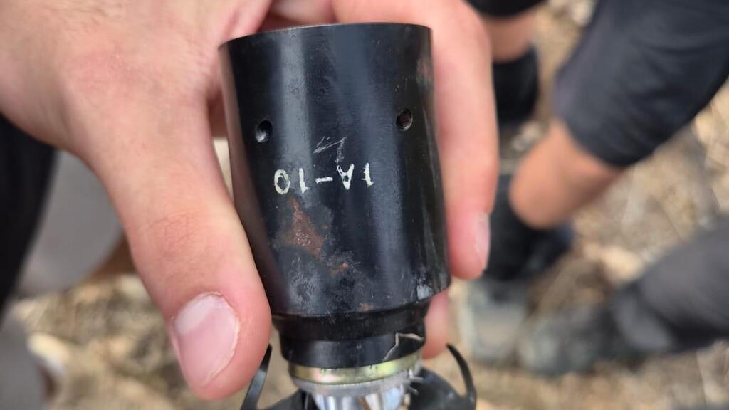
The bomb that exploded on Ramim Ridge
"The circumstances of the incident and the route actually taken are now being examined as part of an investigation by the IDF and police, in cooperation with the Education Ministry and the relevant professional authorities," the statement said. The ministry stressed that the findings of the investigation should be awaited before conclusions are drawn about the circumstances of the tragedy.
The ministry also said it would work with the relevant authorities in the coming days to review the procedures for approving outdoor activities and the safety instructions accompanying them. For now, a central question remains unanswered: Whether the students followed the authorized Israel Trail or entered the nearby scenic road that had been closed because of war damage.