

Fashionably late, after the viral videos had already flooded social media and plenty of hikers had dipped into and posed for photos in the summer’s new swimming spot, veteran spring blogger Chen Yosef set out to see for herself one of the most intriguing additions to Israel’s hiking map: Nahal Tzalmon in the Galilee.
For years, the streambed was dry except during rare winter floods. Now, Mekorot, Israel’s national water company, is channeling water into it as part of the “reverse carrier” project, which sends fresh water flowing toward the Sea of Galilee.
“I saw that a new stream had opened in Israel,” Chen tells ynet. “People laughed at me for saying ‘opened,’ but I honestly didn’t know what word to use — established, inaugurated or prepared. And because of the war, I didn’t get a chance to go. But I kept thinking about the place as something I had to do and had to see. Then winter came, and I wanted to save it for a better time — summer, when the information would actually be useful for hikers.”
The first time Chen visited the revived Nahal Tzalmon, about a month ago, it was during bein hazmanim, the yeshiva vacation period in the ultra-Orthodox community, which begins after Tisha B’Av and continues until the start of the Hebrew month of Elul. During that period, popular springs, streams and nature sites can fill with thousands of visitors.
Chen also discovered that reaching the new pools was far more complicated than she had expected.
“We went through all the bloggers who had published information about the stream and tried getting there from the upper section, and through a point on the map that someone from Ginosar strongly recommended to me, and through the Mekorot site.”
What she found on the ground was different.
“It was an extremely hot day for walking, and everywhere there were signs saying ‘No Entry’ and ‘Private Property.’ Apparently, after all the publicity about the new pools at Nahal Tzalmon, farmers in the area made it clear that those areas were private. And the route that is open involves an hour’s walk, which is a very long time just to reach such a small place. In short, we didn’t know where to enter.”
The solution came after Chen studied the maps carefully and identified another route through the community of Livnim.
“At first we were worried it might be problematic because you enter through the community itself, but when we arrived we saw lots of buses, so we figured it was probably a recognized entrance.”
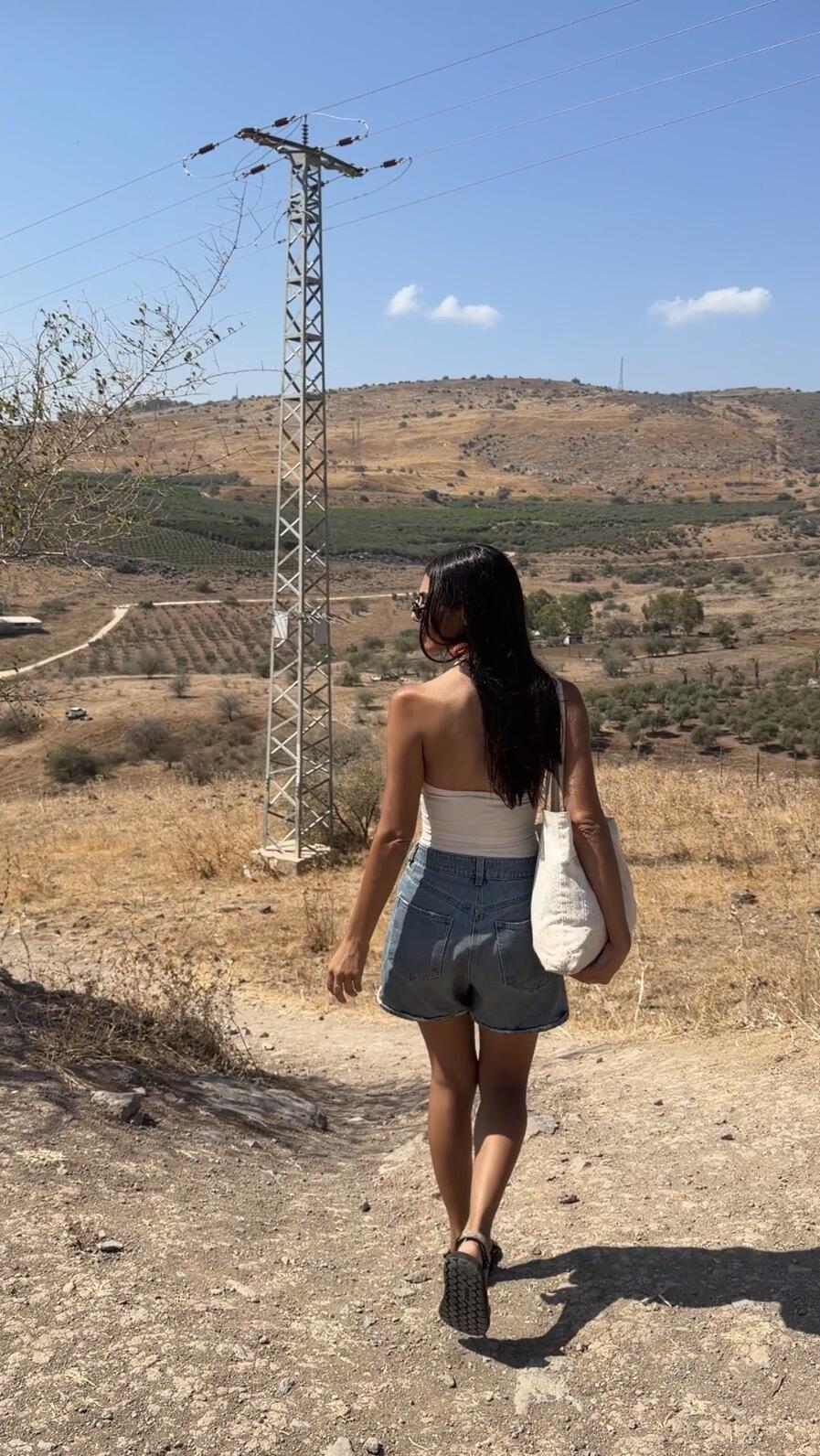
Chen on the way to the stream
(Photo: Courtesy of Chen Yosef)
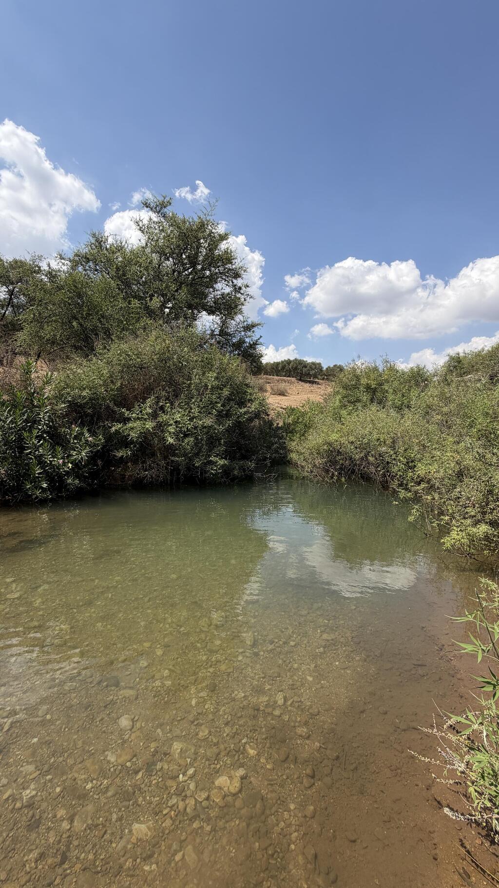
Don’t stop at this spot — keep going
(Photo: Courtesy of Chen Yosef)
It will be worth it
(Photo: Courtesy of Chen Yosef)
“We got really excited about the first pool we saw,” Chen says with a laugh. “When you finish the descent and keep going straight, you reach a spot in the stream where you can swim. It’s fun, relatively deep and surrounded by lots of vegetation. That pool was even empty during bein hazmanim.
“But when we turned left on the trail to get to the perfect pool by the bridge, we couldn’t see a bridge, we couldn’t see water, we couldn’t see anything — the place was absolutely packed with people.”
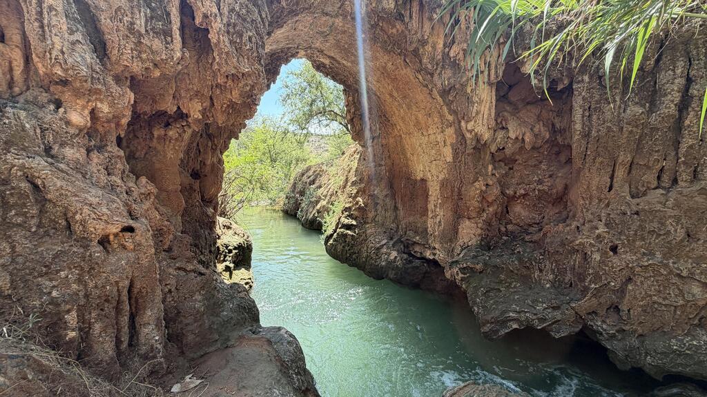
During the Ottoman period, the “travertine bridge” was part of an aqueduct that carried water from Nahal Tzalmon to a nearby flour mill.
The bridge’s unusual appearance was formed by calcium carbonate deposits, also known as travertine, left behind by water dripping from the aqueduct. Over the years, the deposits accumulated and hardened, covering the bridge with porous layers and distinctive formations especially popular with photographers.
After all the searching and effort, Chen’s first visit to the new pools left her disappointed.
“There were so many people that we couldn’t see anything, but we knew we had to come back. We saw the potential and we had seen how the place looked in photos,” she says.
Recently, she returned to the stream in the middle of the week. Spoiler: This time, the experience was entirely different.
“Suddenly we were there alone,” Chen says with a laugh. “People aren’t hiking the way they do in August anymore, and suddenly you can actually see the stunning bridge. I went through a whole journey to get to this place and came back to tell people about it so they wouldn’t have to get tangled up the way I did.”
This time, Chen already knew the easiest route to the pools.
“Suddenly you see this amazing bridge. You don’t even really see it as a bridge — it looks like a cave with a stream running through it,” she says enthusiastically.
“Everything around it is green, and it has that combination I love — clear turquoise water, vegetation, rocks and the arch of the bridge above. It’s really crazy. I love it.”
For now, the route Chen recommends to the new pools goes through the community of Livnim.
“After the yellow gate, you reach a traffic circle, turn right, then right again and continue along a dirt road to the parking area.”
She stresses, however, that there are no signs at the site and the access roads have not yet been formally arranged.
“This is the simplest explanation I found. It’s a new site and they’re still working on making the access easier,” she says.
“I think the ultimate goal is for people not to enter through the community itself, and it’s possible that the community may eventually want to close the gate too. As long as that hasn’t happened, this is the most accessible and convenient route I know.
“I really hope they arrange proper access so it will be pleasant both for residents and for visitors.”
As is often the case in Israel in 2026, there is little coordination between the various authorities, and the public pays the price.
“They opened a new stream, but still haven’t sorted out how people are supposed to get there, so we’re all waiting,” Chen says with a laugh.
“I’ll be the first to publish an organized route once there is one,” she promises.
“For all those years, the place was closed and dry and no water was being channeled there. Suddenly they decided to make it accessible to the public.
“The access still hasn’t been completed, but how great is it to have a new place that’s so beautiful?
“That said, it’s important to point out that the entire section beneath the bridge is very deep water. We couldn’t stand there. People jump into the water, but good luck to them — God forbid, I certainly don’t recommend it.”
The depth of the water and the pool’s small size make it, in her view, better suited to couples, solo hikers and small groups, and less appropriate for families with children.
“I wouldn’t recommend coming here with children,” she says frankly. “The water is extremely deep and the place is also very small.
“If I were going out with a large group, I wouldn’t come here. This is a place for couples, people who feel like taking a solo trip or a very small group, preferably in the middle of the week.
“I have no idea what happens there on Saturdays. Midweek is always perfect — that’s my tip.”
As someone who spends much of her time at wild springs and natural water sources, Chen also pays attention to water quality.
“Maybe because I’m sensitive to water, there was something slightly different in the smell and a tiny bit of salinity that I noticed,” she says.
“It may not feel completely like a natural spring, but the place already has all the characteristics of one — there are fish, vegetation and everything around it looks natural, even if the water itself doesn’t feel entirely like natural spring water.
“It’s also important to say that the water flow is regulated, so the strength of the current and the way the place looks may not be exactly the same every time you come.”
And now for Chen’s tip for getting the place’s signature Instagram shot — the one showing swimmers in the water with the bridge’s impressive arch and surrounding vegetation creating the appearance of a cave.
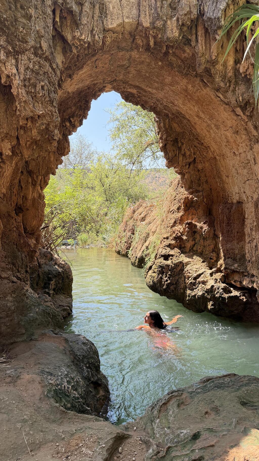
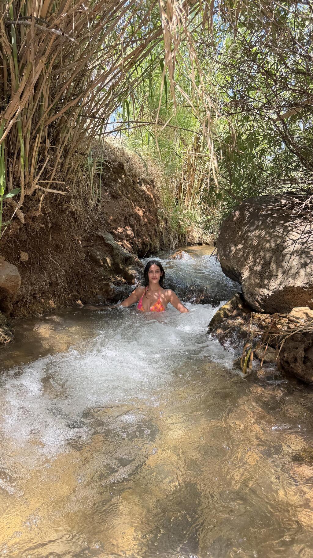
Chen swims at the perfect spot
(Photo: Courtesy of Chen Yosef)
“To reach the best photo spot, you go down the trail beneath an abandoned structure,” she explains.
“That’s the best angle — under the bridge. It sounds like a long explanation because there’s no proper Waze destination, but in reality it’s just a few steps to the place’s Instagram shot.”
To wrap up, Chen has a few more recommendations for a successful visit to the new pools.
Because of the rocks, she recommends wearing sandals. Anyone who finds the pool crowded can combine the visit with other sites around the Sea of Galilee.
But for her, the simple fact that water has returned to the stream is reason enough for excitement.
“We have a small country and everyone already knows everything. So a new stream is genuinely an unusual event.
“May there be many more like it, and may all of Israel’s flowing streams be restored. I hope much more funding is invested and more options are opened up.
“The nature here is stunning, it’s fun to be in it and it’s worth investing in.”
How to get there: Drive along Route 90 beside the Sea of Galilee, pass Kibbutz Ginosar and turn left onto Route 8077. Pass Nahal Amud and the sign for “Nahal Tzalmon — Livnim Parking.”
You can also enter “Moshav Livnim” into Waze and enter the community through the yellow gate. Immediately afterward, you reach a traffic circle and turn right. At the next turn, turn right again, continue to the end of the paved road and take the dirt road leading to the parking area. From there, a short trail descends to the stream.
It is important to remember that there are no signs at the site, the access routes are not formally arranged and the possibility of entering through the community may change.
Warning: Swimming in Nahal Tzalmon is dangerous and the water in the new pool is deep. There are no lifeguard services at the site, and anyone entering the water does so at their own risk.